Los Azulejos, Gran Canaria: the Rainbow Rocks of Veneguera
Los Azulejos de Veneguera, the village and the beach at the end of an 8 km track: how to get there by car or bus 38, hiking routes and safety tips.
Martín PazCanarian Resident · Foodie
Share
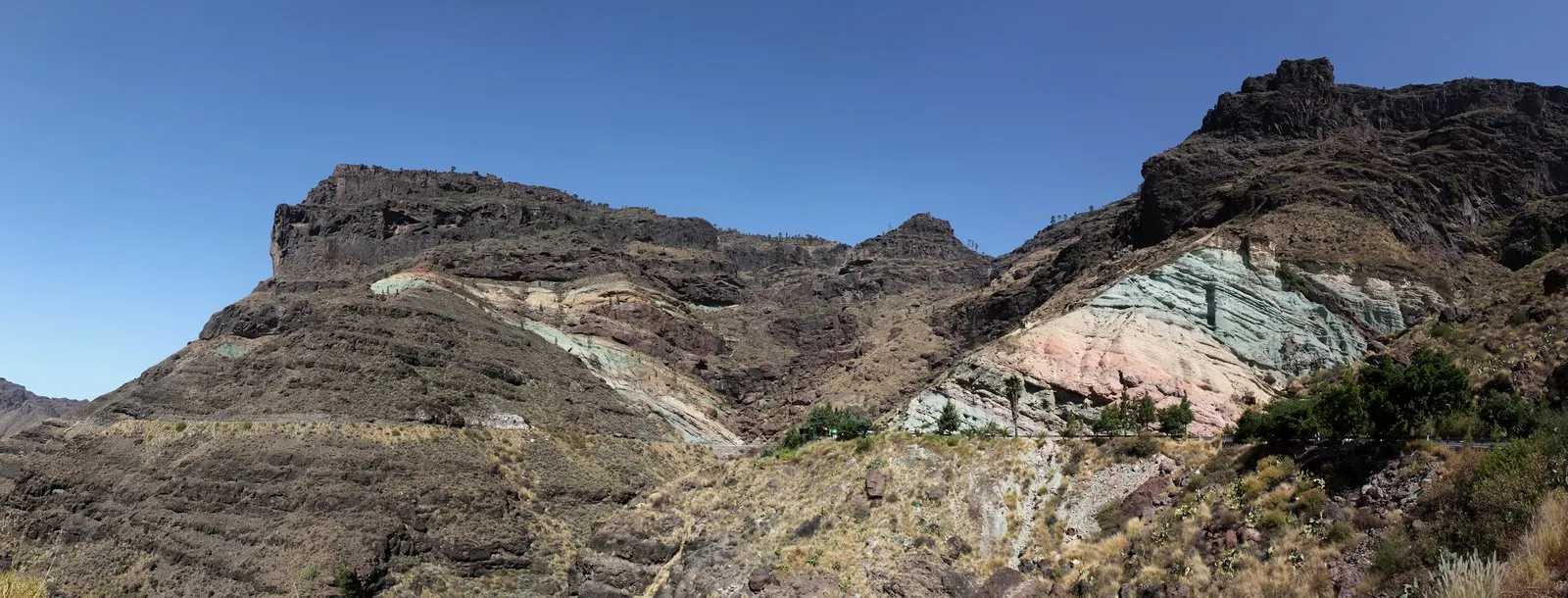
In western Mogán, in the south-west of Gran Canaria, the road leaves the resort beaches behind and climbs into the mountains. Halfway up towards La Aldea, a hillside appears streaked with green, turquoise, ochre and pink: these are Los Azulejos de Veneguera, marked on maps as the Fuente de Los Azulejos and known in English as the Rainbow Rocks. A little further down lies Veneguera, a farming hamlet in its own ravine, and at the end of roughly eight kilometres of dirt track, Veneguera beach, one of the few on the island that are still undeveloped. This guide brings the three stops together with the practical side of each: where to park, how to get there by car or bus, which walking routes are waymarked and what to know before you drive down the track.
Veneguera and Los Azulejos at a glance
Where
Western Mogán, on the GC-200 between Mogán village and La Aldea
Los Azulejos
Volcanic rock coloured by hydrothermal alteration, right by the road
From Puerto de Mogán
About 18 km, half an hour by car
By bus
Global lines 38 and 86, with a stop called “Los Azulejos de Veneguera”
The beach
About 8 km of dirt track from the village; no facilities
Cost
Nothing: open natural area, no ticket office
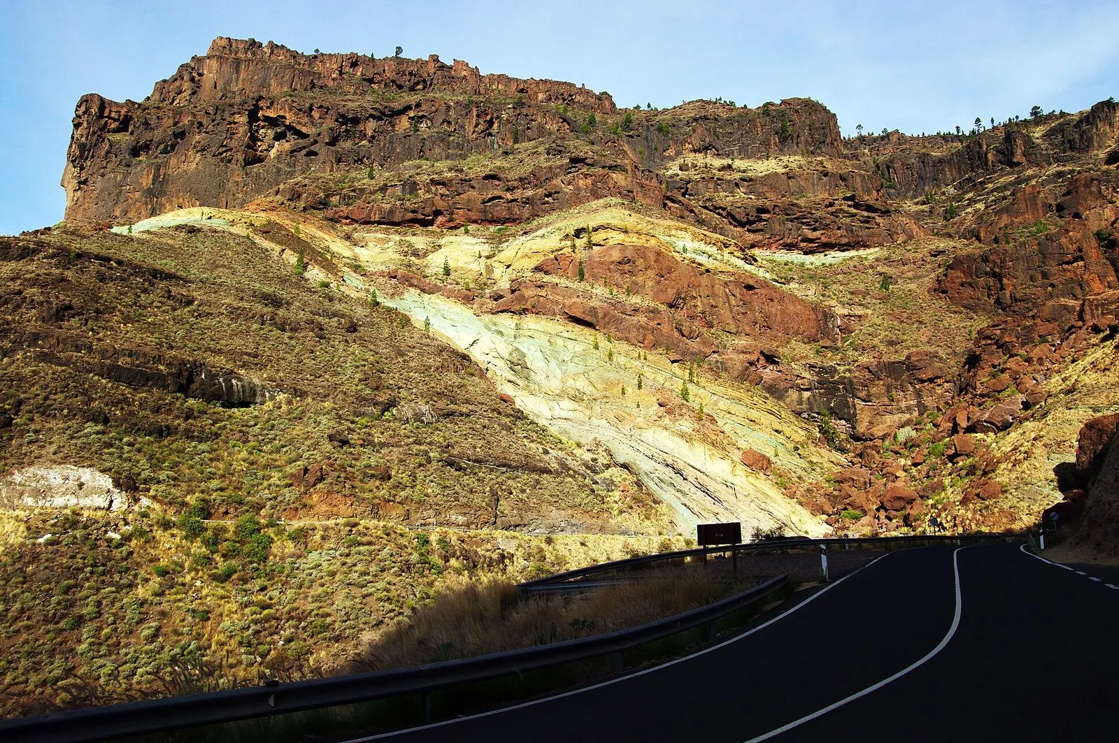
Los Azulejos seen from the GC-200, the road from Mogán to La Aldea.
Los Azulejos de Veneguera: what they are and why they are so colourful
Los Azulejos are layers of volcanic tuff, rock made of ash and fragments thrown out by eruptions millions of years ago, on the rim of the old Tejeda Caldera. What sets them apart from the rest of the mountain is that, after they were laid down, hot fluids circulated through them. That process, known as hydrothermal alteration, changed the chemistry of the rock and left the green, bluish, yellow and reddish tones you can see from the road.
Geological studies of the area, such as the one published by Donoghue and colleagues in 2008, describe it as low-temperature hydrothermal alteration of tuffs from inside the caldera, dating from the Miocene. Mogán’s tourism website sums it up simply: the colours come from hydrothermal alteration of the volcanic tuffs through contact with water. The Spanish Geological Survey (IGME) lists the site as a Place of Geological Interest (record IC3017, “Miocene hydrothermal alteration on the rim of the Tejeda caldera”), with rocks about 13 million years old, and describes it as one of the best examples of hydrothermal alteration in the islands.
Local people gave it its name: the hillside looks like a wall lined with glazed tiles (azulejos) in different colours. On maps you will also find it as Fuente de Los Azulejos, and in English it has caught on as the Rainbow Rocks.
The Los Azulejos route, filmed by Gran Canaria Tourism for its official channel (in Spanish).
Not the same as Barranco de las Vacas. They look alike in photos, but the process is different. At Barranco de las Vacas (Agüimes) it is water polishing the tuff and oxidation producing the oranges; at Los Azulejos it is hydrothermal alteration staining the rock green and turquoise. If you see both on the same trip, you will notice the difference straight away.
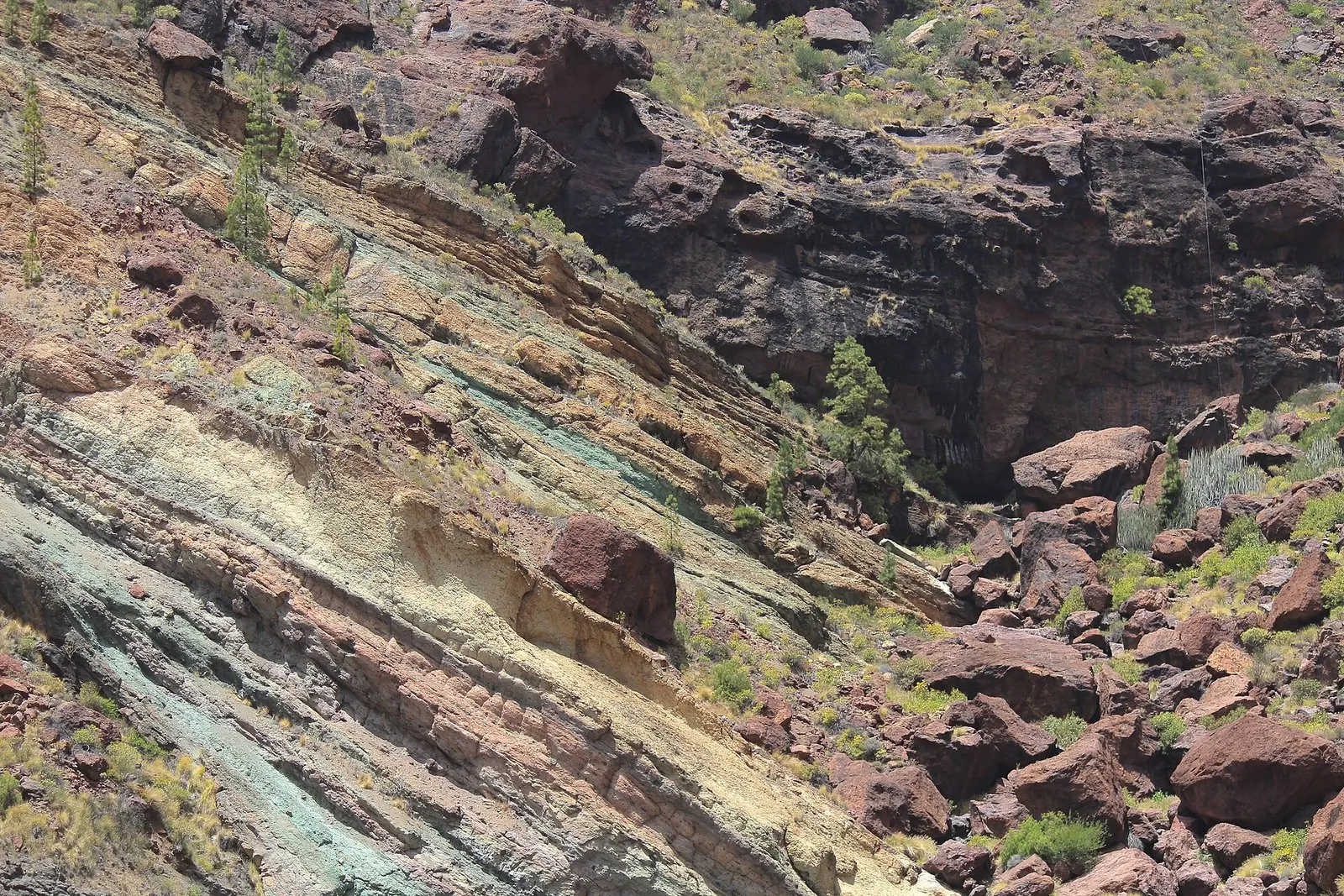
Up close you can pick out the layers: each band of colour is a separate deposit.
Where to find Los Azulejos de Veneguera and where to park
The coloured outcrops can be seen along several kilometres of the GC-200, the road that climbs from Mogán village towards La Aldea de San Nicolás, between kilometre posts 41 and 50, according to the IGME record. The classic place to stop is about 3 km north of the Veneguera turn-off: a roadside lay-by with room for only a few cars, next to the “Los Azulejos de Veneguera” bus stop.
The waymarked trail that climbs the side ravine starts right there (more on that in the walking section), and there is usually a small fruit juice stall. There are no toilets, no drinking water and no shade: bring whatever you need from Mogán village.
The car park is small and fills up around midday and at weekends. If it is full, not just any gap will do: the GC-200 is narrow, with tight bends and plenty of cyclists, and leaving the car on the verge or just after a bend is the quickest way to cause a scare. Better to turn round, wait a few minutes or come back later.
Safety at Los Azulejos. The altered rock crumbles easily and the slopes shed stones: do not climb them or stand at the foot of the cuttings. Do not scratch the rock or take pieces away: this is listed geological heritage. And after heavy rain, check the state of the GC-200 before setting off, because rockfalls are common on this road.
How to see them at their best: light, rain and viewpoints
Going by the lie of the land, the coloured slopes beside the car park face south-west and west, so the sun usually hits them head-on in the afternoon, when the greens and ochres look most intense; the big crag across the road faces further south and gets light for most of the day. Treat this as a rough guide, as each side ravine faces its own way and the light shifts with the seasons. Early in the day the slopes by the car park are in shade and the colours look flatter. Under cloud the tones soften but still read well, and the light suits detail shots.
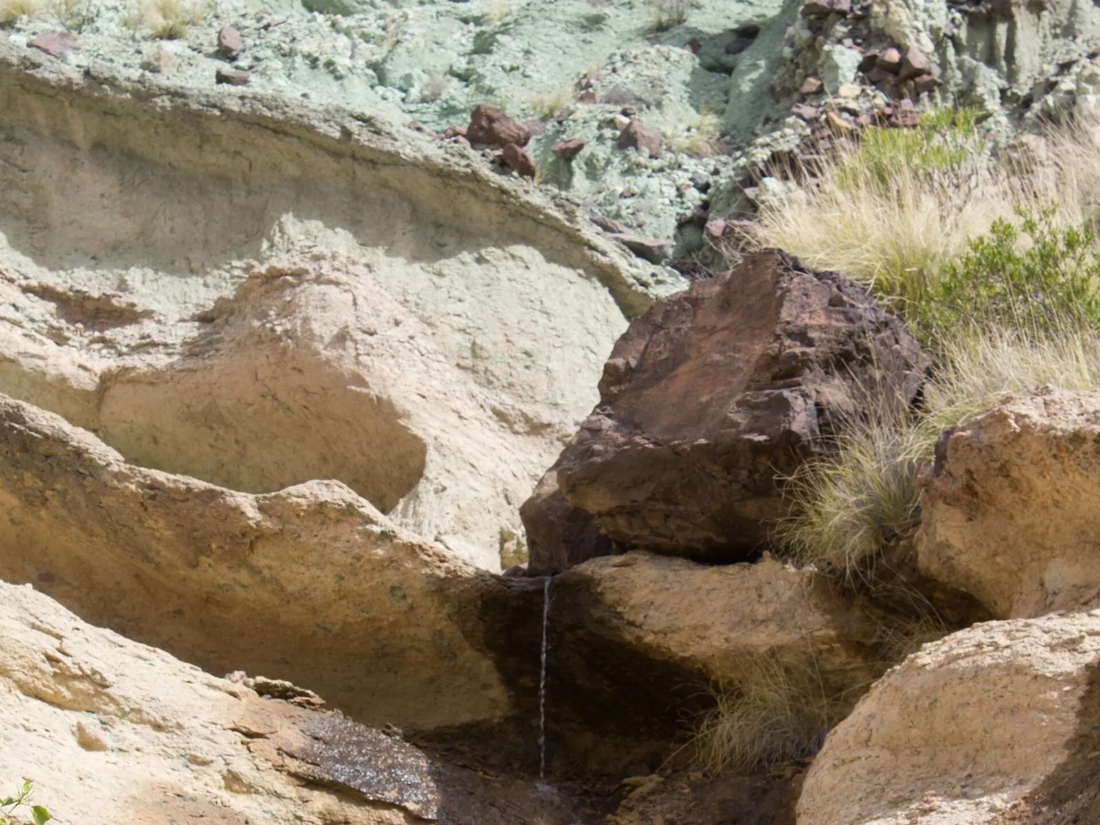
The other big moment is after rain. Mogán’s tourism website describes water-polished pools on the climb from Los Azulejos and waterfalls that only run with the rain, which is sporadic here; wet rock also brings out more saturated colours. It only happens a few times a year, usually between autumn and winter, which is why the photos with water spread so widely on social media.
The waterfalls running at Los Azulejos after storm Claudia, in November 2025. Video by the Ese otro yo. Senderismo channel.
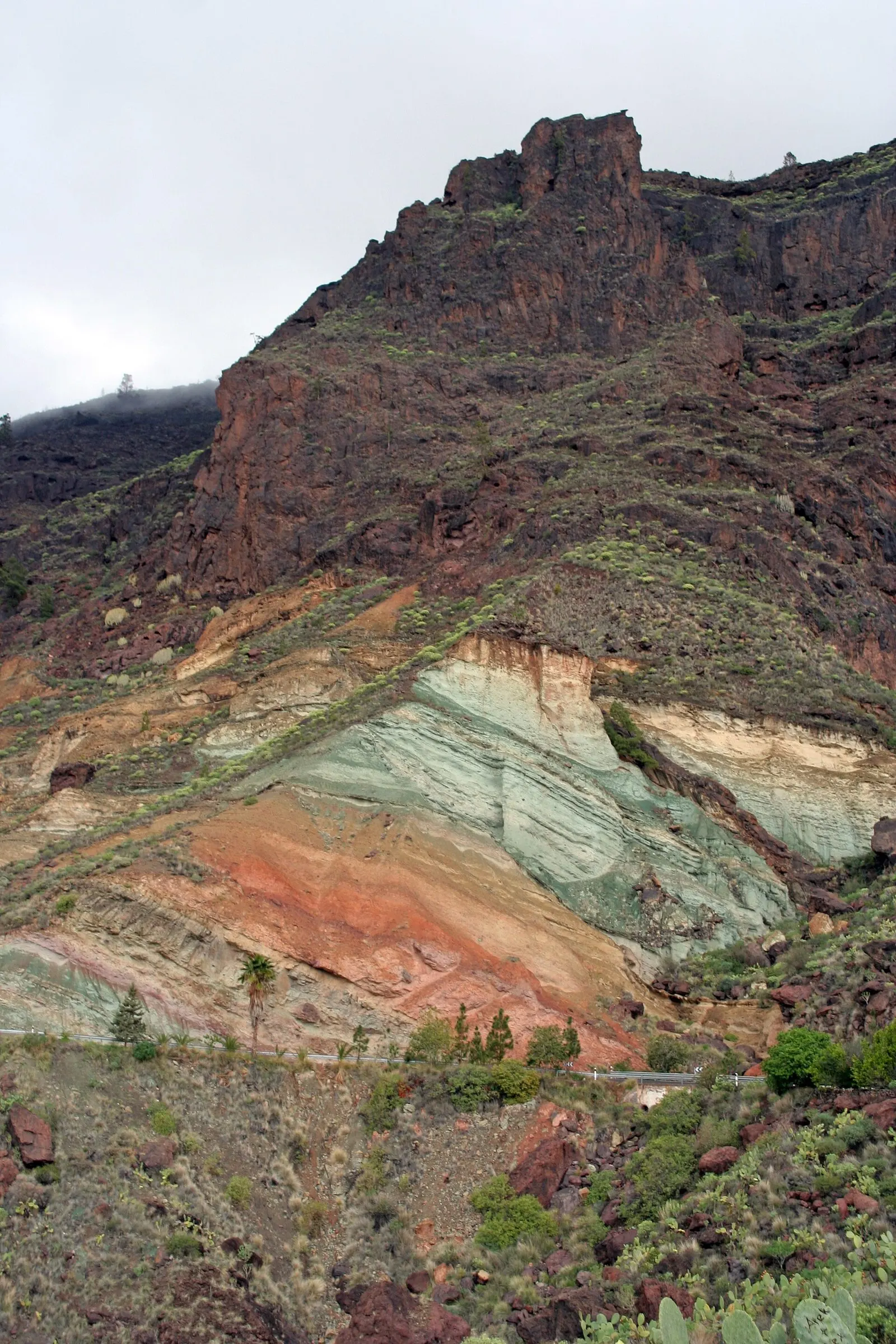
The whole hillside, with the rocky peak above the tuff.A thin stream of water between the green tuffs of the gully, next to the car park.
To see the whole scene from above, stop at the Mirador de Veneguera, on the pass of the GC-200 between Mogán and Veneguera. According to Mogán Tourism, from there you can see the Mogán and Veneguera ravines with Los Azulejos in the background. It is a five-minute stop that puts the whole landscape of this guide into a single view.
Veneguera village: the hamlet in the ravine
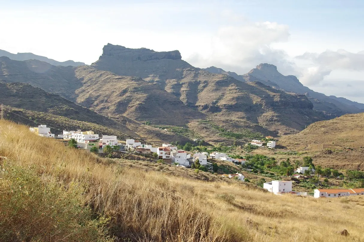
Casas de Veneguera, the village everyone simply calls Veneguera, is about 3 km from Los Azulejos, down the road and a short detour off the GC-200. It is a hamlet of white houses in an arid valley that turns green in winter, surrounded by fruit farms: avocados, papayas, mangoes and citrus, with some remains of the old export crops of bananas and tomatoes.
Casas de Veneguera, with the ravine opening out towards the sea.
It is worth leaving the car and taking a short stroll. The village has its square, the church of Nuestra Señora de Fátima and the old houses of Casas del Almácigo, which Gran Canaria Tourism recommends exploring on foot. Next to them is La Cardonera, a grove of huge cardón, the euphorbia endemic to the Canaries, where at Christmas the village stages its living nativity scene, with more than forty scenes performed by local people.
For food or a drink, the go-to place is the bar on the square. Before heading down to the beach, also make use of the village grocery shop to buy water and something to eat: there is nothing at the bottom.
Salvar Veneguera: the ravine that was never developed
If Veneguera beach is still wild, that is no accident. In the 1980s the ravine carried development rights for a large tourist scheme, which is why the 1987 Canary Islands protected areas law left it out. In response to those plans, the Salvar Veneguera (Save Veneguera) movement was born, and it ended up taking a popular legislative initiative to the Canary Islands Parliament.
A first law, in 1998, fell short of what the initiative had asked for. The outcome was Law 6/2003 of 6 March, which repealed it and declared the Veneguera ravine a Rural Park, added it to the Nublo Rural Park and classified the whole area as rural land that cannot be developed. The law itself lists the values it set out to protect: according to its preamble, the most important reserve of cardón and tabaiba scrub in Gran Canaria, coastal cliffs where seabirds nest, and archaeological sites such as the settlement of the Castillo de Tabaibales.
The story still has loose ends. The former developer fought in the courts for years, and a ruling of July 2024, final since that October, ordered Mogán Town Council to return or pay compensation for land the company had handed over to the municipality, including the La Cardonera plot where the nativity scene is held. There is also an ongoing debate about how the area should be managed. For visitors, the practical upshot is simple: you explore the ravine for what it is, a protected area with no hotels.
Veneguera beach: what it is like and how to get there on the track
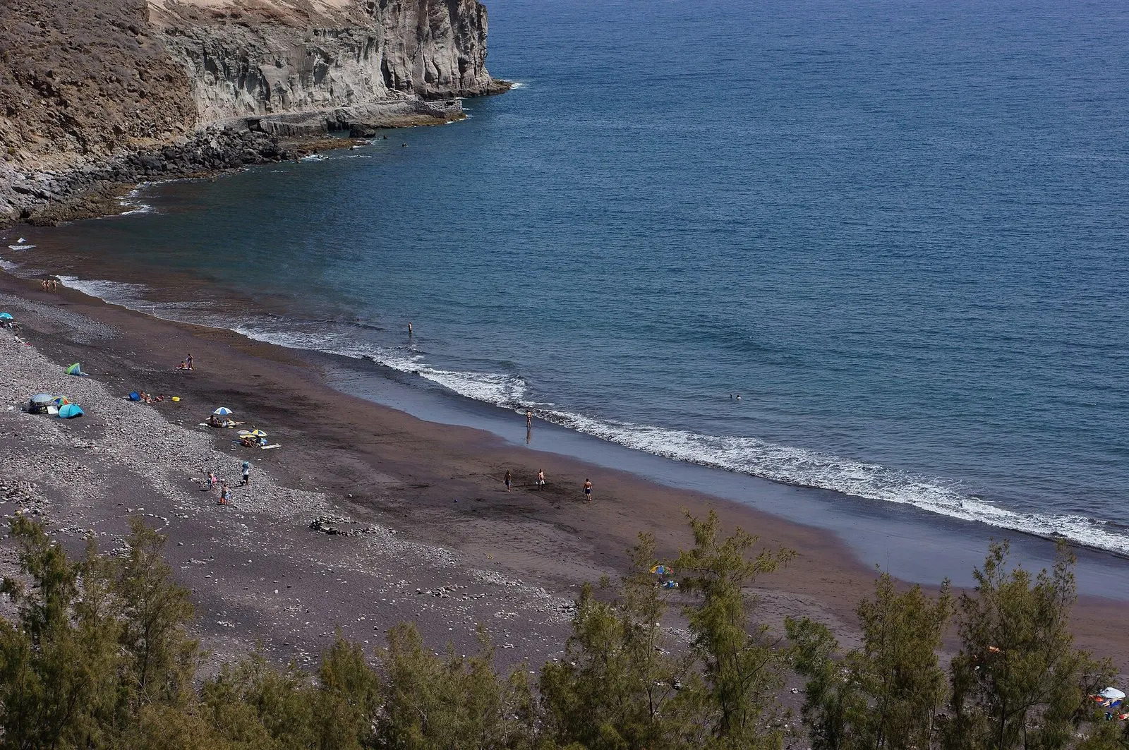
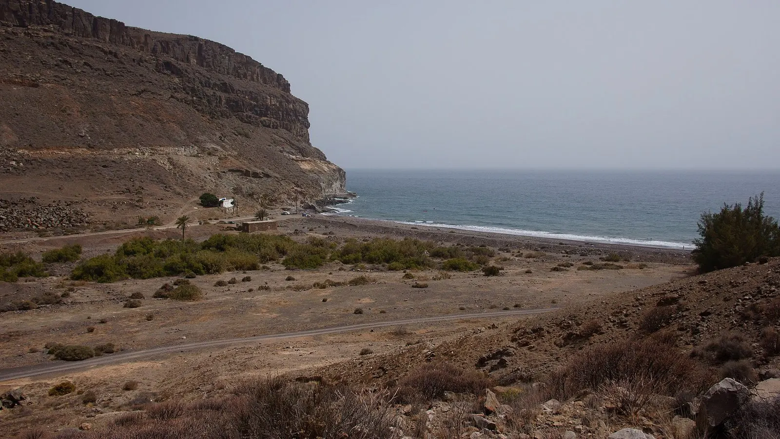
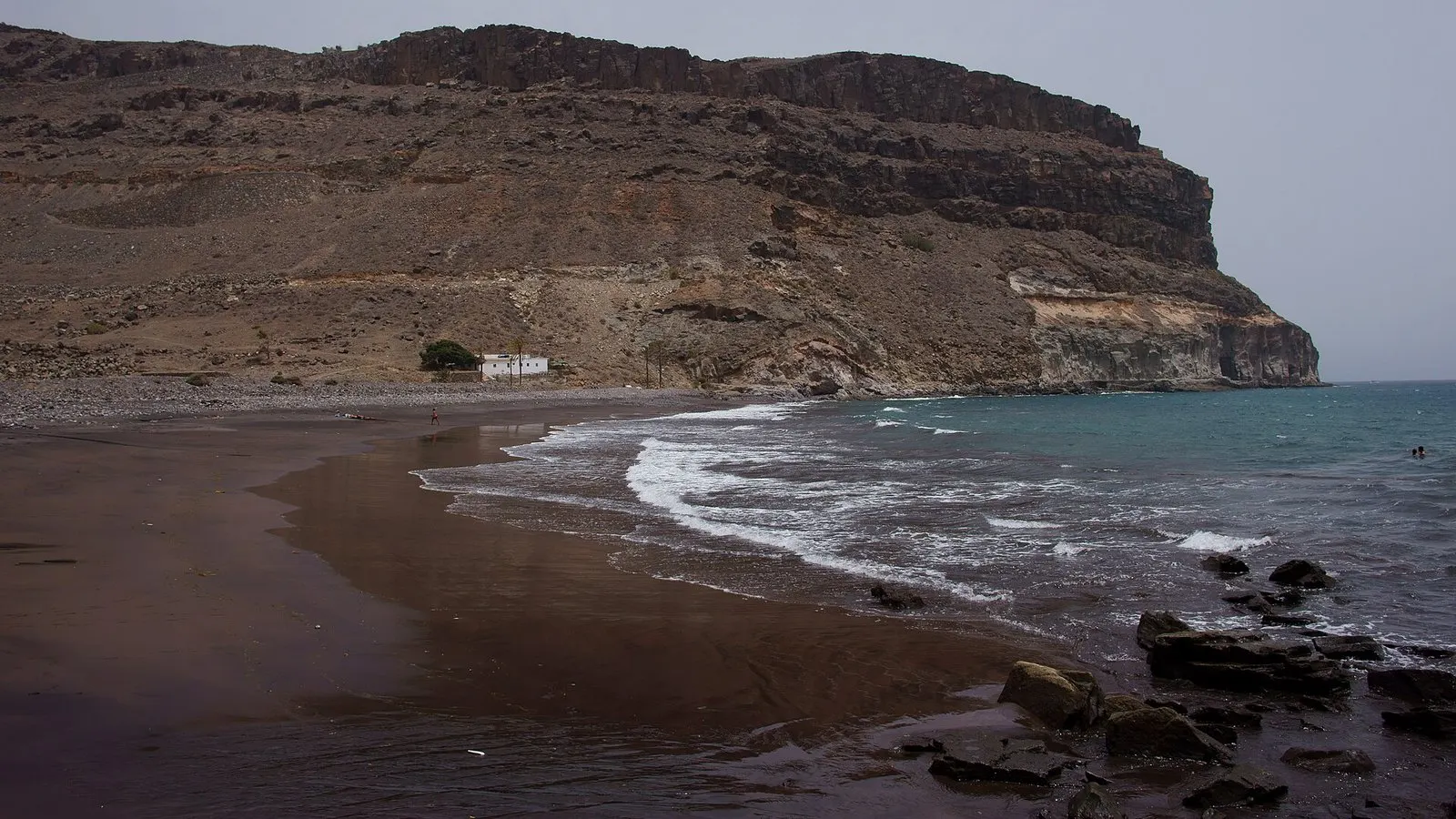
The beach sits at the mouth of the ravine, about 8 km from the village along a dirt track that runs down between farms and palm trees. Mogán Tourism describes it as a beach of around 370 metres, of black sand or rocks depending on the tide, with moderate waves and an isolated setting. In practice it is a mixed beach: boulders, gravel and dark sand, with more sand or more stone depending on the day.
Veneguera beach from the hillside: dark sand, pebbles and cliffs on both sides.
Beach at a glance
Surface
Black sand, gravel and boulders depending on the tide
Length
About 370 m
Waves
Moderate; coast open to the south-west
Facilities
None: no lifeguard, no beach bar, no showers
Access
About 8 km of dirt track from the village
Best for
Anyone after an undeveloped beach who comes prepared
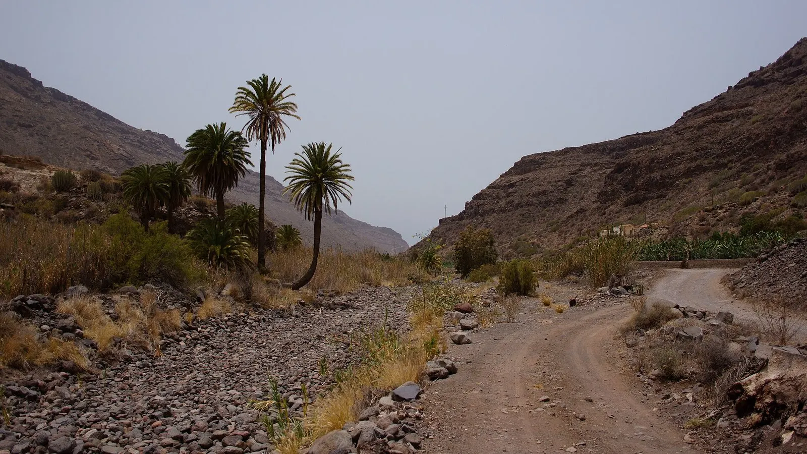
The key question is the car. Gran Canaria Tourism recommends driving the track in a vehicle suited to the terrain. It is a dirt track with potholes, stones and dust, its condition changes a lot after rain, and it has to be taken slowly: allow far more time than the distance suggests. If you are in a hire car, check the contract first, as many exclude cover on unpaved roads.
The track runs down the ravine between palms and farms.The final stretch: the mouth of the ravine with the beach beyond.
Once you are down there, there is nothing: no shade, no water and no guaranteed phone signal. Bring plenty of water, a sunshade, shoes for the pebbles and something to eat. Mogán’s tourism website also notes that nudism is practised on this beach; if you are looking for others like it on the island, see our guide to nudist beaches in Gran Canaria.
Before you swim at Veneguera. This is open coast with no lifeguard. Waves are usually moderate, but when a swell comes in, undertow and currents can form, and the boulder bottom makes getting in and out awkward. If the sea is breaking hard on the shore, stay on the sand. And do not drive down the track if rain is forecast: the ravine is a watercourse.
The shoreline: dark sand, rocks and the cliff closing the bay to the south.
The Veneguera ravine and beach in three minutes. Video by the Local Guide Gran Canaria channel (in Spanish).
If you would rather not take the car down the track, there is another way to see the beach: from the sea. Some boat trips from Puerto Rico anchor off Veneguera (or neighbouring Tiritaña) for a swim and some snorkelling, and jet ski tours from Taurito and Playa de Mogán follow this coast towards Tasarte.
By car from the south, take the GC-1 to where it ends at Puerto de Mogán and carry on along the GC-200 towards La Aldea, which climbs the ravine to Mogán village. The road climbs to the Mirador de Veneguera, drops to the village turn-off and continues to Los Azulejos. From Puerto de Mogán it is about 18 km and half an hour. Coming from the north, you can arrive from Agaete via La Aldea.
Distances from Los Azulejos
By road, without traffic. Add a good fifteen minutes in high season.
DestinationKmTime
Casas de Veneguera3 km6 min
Mogán village10 km20 min
Tasarte (village)8 km15 min
La Aldea de San Nicolás15 km30 min
Puerto de Mogán18 km30 min
Puerto Rico25 km40 min
Maspalomas39 km50 min
By bus, the route is Global line 38 (Puerto de Mogán – La Aldea de San Nicolás), which leaves from Puerto de Mogán bus station, bay 4, climbs through Mogán village and stops at Veneguera, at the Cruce de Veneguera and at Los Azulejos de Veneguera. Departures are few: on the timetable checked in November 2026, it left Puerto de Mogán from Monday to Saturday at 7:00, 11:40, 16:00 and 19:40, and only twice on public holidays. The return to Puerto de Mogán left La Aldea from Monday to Saturday at 5:45, 9:30, 14:05 and 17:30 (also at 8:00 on weekdays), and on public holidays at 9:00 and 19:55; it reaches Los Azulejos a little later. Line 86 (Puerto de Mogán – Playa de Tasarte) also passes Veneguera and Los Azulejos, with one or two departures a day. Timetables change, so always check the current ones at guaguasglobal.com and plan your return too.
Note that no bus goes down to the beach. The nearest stop is in the village, about 8 km of track away. If you are coming from the airport or Las Palmas, the first leg is explained in how to get to Puerto de Mogán.
Walking routes: Veneguera, Cruz de Mogán, Tasarte and Inagua
Veneguera is serious walking country, with waymarked paths that Mogán Town Council publishes on its tourism website. These are the three that tie in directly with this guide:
Route
Distance and time
Effort
Itinerary
R1 Veneguera – Cruz de Mogán
7.79 km, about 3 h 30 min
Low to moderate
Degollada de Tasarte, Casas de Veneguera, Cruz de Mogán and Mogán village
R2 Los Azulejos – Los Quemados
6.68 km, about 3 h 30 min
Moderate to high
From Los Azulejos, up to the Llanos de Ojeda and down to the Roque de Veneguera
Los Azulejos – Veneguera trail
14 km, 557 m of ascent
For walkers with some experience
Version restored in 2025: pools, Llano de la Bruma, Los Quemados and descent to Veneguera
The R1 is the easiest to fit in: it links the Veneguera ravine with the Mogán ravine via the Cruz de Mogán, the traditional meeting point for people from the two villages, and passes the hamlet of La Cogolla and stands of huge cardón. Its signposts carry the reference S-73.
The R2 starts from the same Los Azulejos car park and climbs hard up the side ravine, past the Charcas de las Aneas and the Charco Azul pools, to the old pines of the Llanos de Ojeda. It skirts, without entering, the Inagua Integral Nature Reserve, a pine forest protected by law where only scientific and, exceptionally, educational use is allowed. In July 2025 the council announced it had restored the 14 km trail between Los Azulejos and Veneguera, and recommends walking it only between October and May: in summer the heat on these shadeless slopes is punishing.
The trails towards Ojeda and Inagua start beside these slopes.
A road trip through the west: Mogán, Los Azulejos, Tasarte and La Aldea
Veneguera and Los Azulejos fit neatly into a day on the road through the west of the island, for us one of Gran Canaria’s most scenic drives. This is how we would plan it from Puerto de Mogán:
Western Mogán in a day
9:00
Coffee in Mogán villageUp the ravine from Puerto de Mogán. A stroll round the square and the church of San Antonio before carrying on along the GC-200.
9:45
Mirador de VenegueraA short stop on the pass: both ravines with Los Azulejos in the distance.
10:15
Veneguera villageA walk round the houses and La Cardonera. Buy water if you are heading to the beach.
11:00
Veneguera beach (optional)Only with a suitable vehicle and the track in good condition. A swim and an unhurried return.
15:00
Los AzulejosIn the afternoon the sun usually falls on the slopes by the car park. Ten minutes of photos or a short stretch of the trail.
16:00
Tasarte and La AldeaCarry on along the GC-200: the turn-off to Tasarte and, further on, La Aldea de San Nicolás to round off the day.
If you would rather not drive, the round-the-island coach tour includes a stop at Los Azulejos on the way to La Aldea and the north, and is an easy way to see this road from the window.
Coordinates from OpenStreetMap. Each button opens directions in Google Maps.
The good and the not so good
The good
Los Azulejos can be seen from the road itself, free and without walking
One of the few undeveloped beaches in Gran Canaria, protected by law
A quiet village with a bar, a shop and a short stroll among traditional houses
Waymarked routes for every level, from the R1 to the Llanos de Ojeda
You can reach the village and Los Azulejos by bus
The not so good
Small car park at Los Azulejos and a narrow, winding road
The beach track needs a suitable vehicle and patience
No facilities on the beach or at the Los Azulejos lay-by
Few buses a day: you have to plan the return
Fierce heat in summer on the shadeless trails
Frequently asked questions
Before you go
Where exactly are Los Azulejos de Veneguera?
On the GC-200, the road from Mogán to La Aldea de San Nicolás, about 3 km north of the Veneguera turn-off. The place to stop is the lay-by with parking next to the “Los Azulejos de Veneguera” bus stop. From Puerto de Mogán it is about 18 km.
Why are Los Azulejos so colourful?
They are volcanic tuffs from the rim of the old Tejeda Caldera altered by hot fluids (hydrothermal alteration), which changed their chemistry and gave them green, bluish, ochre and reddish tones. The name comes from their likeness to a wall of glazed tiles.
What is the best time of day to see Los Azulejos?
Given the way the slopes beside the car park face, the sun usually falls on them head-on in the afternoon, which is when the colours look most intense; early in the day they are in shade. On the days after rain the wet rock shows more saturated colours and, now and then, the waterfalls in the side ravine are running.
Are the Fuente de Los Azulejos and Los Azulejos de Veneguera the same place?
Yes: they are two names for the same spot on the GC-200. “Fuente de Los Azulejos” is the name on many maps, and in English it is often called the Rainbow Rocks.
Can you reach Veneguera beach in a normal car?
The beach is about 8 km of dirt track from the village, and Gran Canaria Tourism recommends driving it in a vehicle suited to the terrain. The state of the track varies a lot after rain. If you are in a hire car, check whether the insurance covers unpaved roads.
Are there any facilities at Veneguera beach?
No. There is no lifeguard, beach bar, showers or shade. Bring water, food and sun protection from the village, which has a bar and a grocery shop.
Is it a nudist beach?
Mogán’s tourism website lists it among the beaches where nudism is practised. As it is an isolated beach, people with and without swimwear share it.
Which bus goes to Veneguera and Los Azulejos?
Global line 38, from Puerto de Mogán to La Aldea, stops at Veneguera and at Los Azulejos de Veneguera; line 86, towards Playa de Tasarte, does too. Both have few departures a day, so check the current timetable at guaguasglobal.com.
How much time do I need?
Los Azulejos from the road, ten or fifteen minutes. The village, half an hour. The beach, half a day including the track. Add a walk and it is a full day.
In short
Veneguera is three outings in one: Los Azulejos, which you can see from the road and which usually look their best in the afternoon light; the village, peaceful and with its bar on the square; and the beach, wild and protected, earned with 8 km of track and a suitable vehicle. Only park where there is room, take water and, if you are travelling by bus, check the return before you set off.
To keep planning: our guide to Mogán covers the rest of the municipality, and if you like undeveloped beaches there are more in the best beaches in Gran Canaria. For a swim on the coast, Taurito beach is reached via the GC-1, though it is not on your way: its junction only connects in the Puerto Rico direction and the old coast road is still closed. For calm-water swimming without a track to tackle, see the island’s natural pools. And if you are thinking of bringing a tent, first read where you can camp in Gran Canaria: there is no designated area at Veneguera beach.
Image credits
Bgabel · CC BY-SA 3.0 · vía Wikimedia Commons · Victor R. Ruiz from Arinaga, Canary Islands, Spain · CC BY-SA 2.0 · vía Wikimedia Commons · Tony Hisgett from Birmingham, UK · CC BY 2.0 · vía Wikimedia Commons · Markus G. Klötzer · CC BY-SA 4.0 · vía Wikimedia Commons · Jarek Prokop · CC BY 3.0 · vía Wikimedia Commons · H. Zell · CC BY-SA 3.0 · vía Wikimedia Commons
The critical eye behind every recommendation. A Canarian local and self-confessed foodie who knows every corner of Mogán. His mission: for every visitor to experience Mogán like a local.
Local Tip
From the heart of Mogán
“First thing in the morning is the best hour of the day along this whole coast and almost nobody uses it: flat water, no wind, the best light and empty terraces.”
How to get to Puerto de Mogán by bus, ferry, car or taxi: Global bus lines and fares, the Puerto Rico to Mogán ferry timetable, parking and taxi prices.