The whole municipality in one guide: every beach compared, the village and the ravine, when to go where, how to get around, and complete plans for one day, a weekend or a week.
Martín PazCanarian Resident · Foodie
Reviewed
Share
Mogán is not a village. It is almost twenty-four kilometres of coast and a 172 km² municipality that climbs from the sea to more than 1,500 metres. That is worth understanding before anything else, because it explains why people who come “to Mogán for the day” almost always leave having seen a tenth of it. This guide is the whole map: what is here, where it is, and the order that makes sense.
A walk through the town, the canals and the harbour. Video by JoyOfTraveler.
Mogán in numbers
Where
The far south-west of Gran Canaria
Size
172.44 km², the island’s second-largest municipality
From the airport
About 60 km, close to an hour
Coastal resorts
East to west: Arguineguín, Patalavaca, Anfi, Puerto Rico, Amadores, Tauro, Playa del Cura, Taurito and Puerto de Mogán
Highest point
1,583 m at Montaña de Sándara (Alsándara), on the Tejeda boundary
Best time to visit
Any: just 7,3° between the warmest and coolest month
The municipality at a glance
Get your bearings first. Everything in this guide fits on this map, and the distances are shorter than they look:
The geography is easy to hold in your head once you see it: one coast road threading the resorts from east to west, and several ravines climbing inland towards the summit. Almost all the tourism stays on the first. Almost everything interesting that is not in the brochures is up the second.
Distances from Puerto de Mogán
By road, without traffic. Add a good fifteen minutes in high season.
DestinationKmTime
Arguineguín17 km18 min
Puerto Rico9 km11 min
Amadores10 km13 min
Taurito4 km6 min
Mogán village9 km15 min
Veneguera15 km30 min
Maspalomas35 km30 min
Airport60 km50 min
Las Palmas90 km1h 15
Complete plans, by how long you have
The question we get is not what to see but in what order. These are finished plans rather than lists to pick from: each one is built so the distances and the hours actually fit together.
How long have you got?
Open the one that matches your trip. Each is a complete plan, not a list to pick from.
I only have one day8 hours
Choose the coast or the interior. Attempting both is the surest way to enjoy neither. If it is your first visit, stay on the coast.
9am. Reach Puerto de Mogán before the excursions do. Canals, the pedestrian centre and the fishing harbour with the day’s catch coming in.
11am. Swim at Playa de Mogán, the most sheltered water on the south coast.
1:30pm. Lunch two or three streets back from the seafront, not on it.
3:30pm. Express boat to Puerto Rico (the boat links Puerto de Mogán with Puerto Rico and Arguineguín; it does not stop at Amadores). The cliffs along this stretch only open up from the water.
5:30pm. From Puerto Rico, walk the seafront promenade to Amadores if you still have the energy.
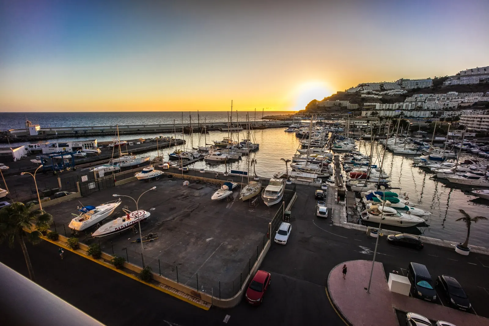
7pm. Sunset from Puerto de Mogán. This is the hour people remember.
I have a weekend2 days
One day on the coast, one inland. That split shows you the essentials of the municipality without repeating the same landscape.
Day 1, morning. Puerto de Mogán early: canals, old town, harbour.
Day 1, afternoon. Beach at Amadores or Taurito, then a boat trip at sunset.
Day 2, morning. Drive up to Mogán village and the ravine. Set off before nine in summer.
Day 2, midday. Carry on up the Mogán valley towards Veneguera and the Fuente de Los Azulejos on the GC-200 (Presa de Soria sits in a different basin, the Barranco de Arguineguín, and deserves a day of its own).
Day 2, afternoon. Drop down to Arguineguín for fish and finish on the promenade.
I have a week5-7 days
A week is enough to use Mogán as a base and get out into the rest of the island. This is the split that works.
Day 1. Settle in: Puerto de Mogán and its beach, no car needed.
Day 2. The sea: whale and dolphin watching, or a catamaran trip.
Day 3. Inland: Mogán village, the ravine, the reservoirs and the miradors.
Day 4. Beaches: Amadores in the morning, Veneguera if you fancy the rough track.
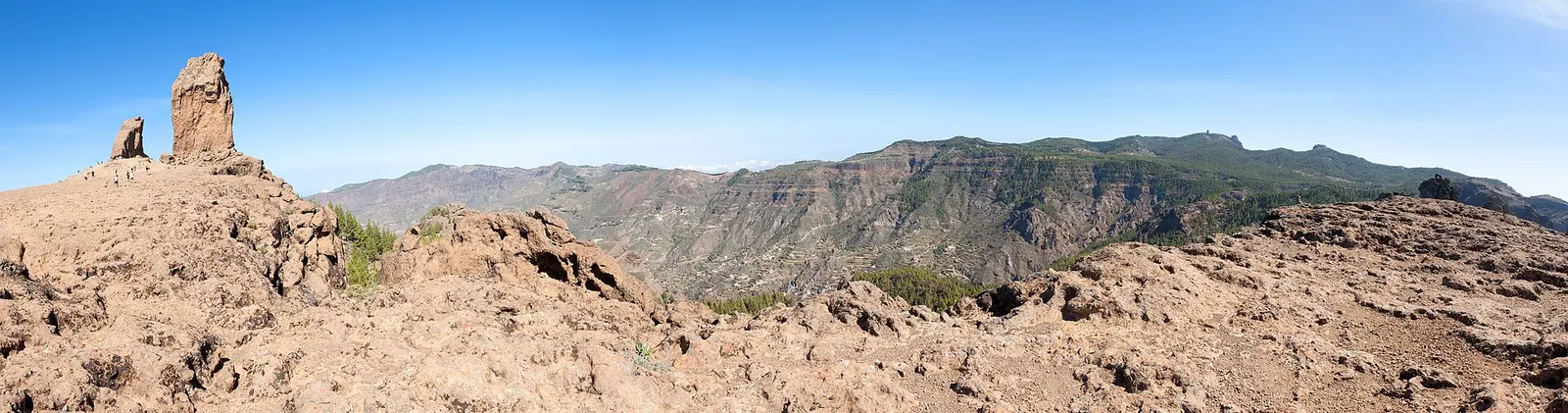
Day 5. The island summit: Roque Nublo and Tejeda. A full day.
Day 6. Las Palmas or the green north, which is a different island entirely.
Day 7. Friday market in Puerto de Mogán and a farewell sunset.
The coast, resort by resort
The coastal settlements thread east to west along the shore, all within a few minutes of each other, and they do not compete: each suits a different kind of day. This table is probably the most useful thing on the page.
Desliza para ver la tabla completa →
Resort
Character
Its beach
Choose it if…
Arguineguín
Working fishing town
Pebble, sheltered by the pier
You prefer local prices and less shop window
Patalavaca
Residential and quiet
Imported sand, very calm
You want to sleep without noise
Anfi del Mar
Enclosed-bay resort
Artificial, pale sand, no swell
You want the calmest swim, with children
Puerto Rico
Busy and commercial
Wide, gentle surf
You want an active base with everything to hand
Amadores
Artificial bay, pale sand
No swell at all
You have young children, or the sea is up
Tauro / Playa del Cura
Smaller, quieter
Sand and gravel, gentle surf
You want a beach without the Puerto Rico bustle
Taurito
Closed valley, pool complex
Dark volcanic sand, moderate swell
You want quiet and saltwater pools
Puerto de Mogán
Canal village, human scale
Small and very sheltered
You want the prettiest place in the municipality
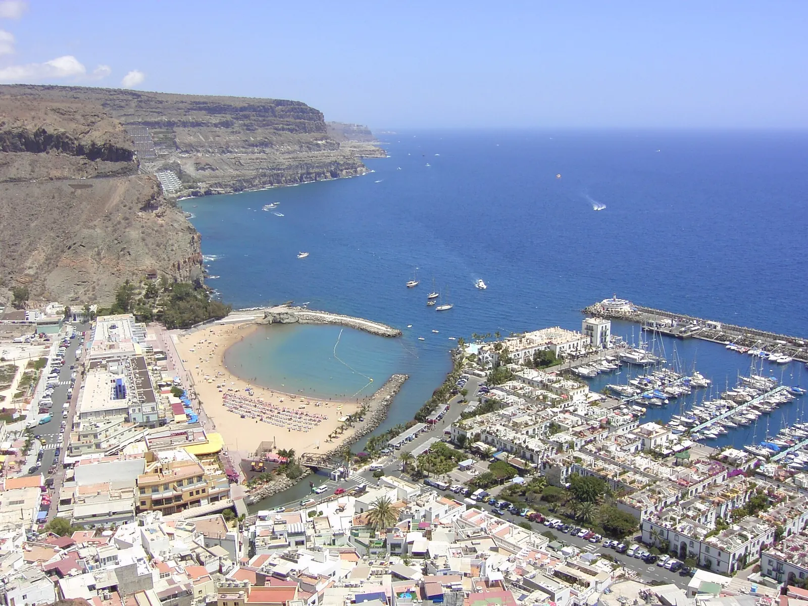
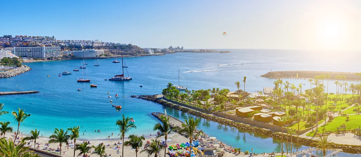
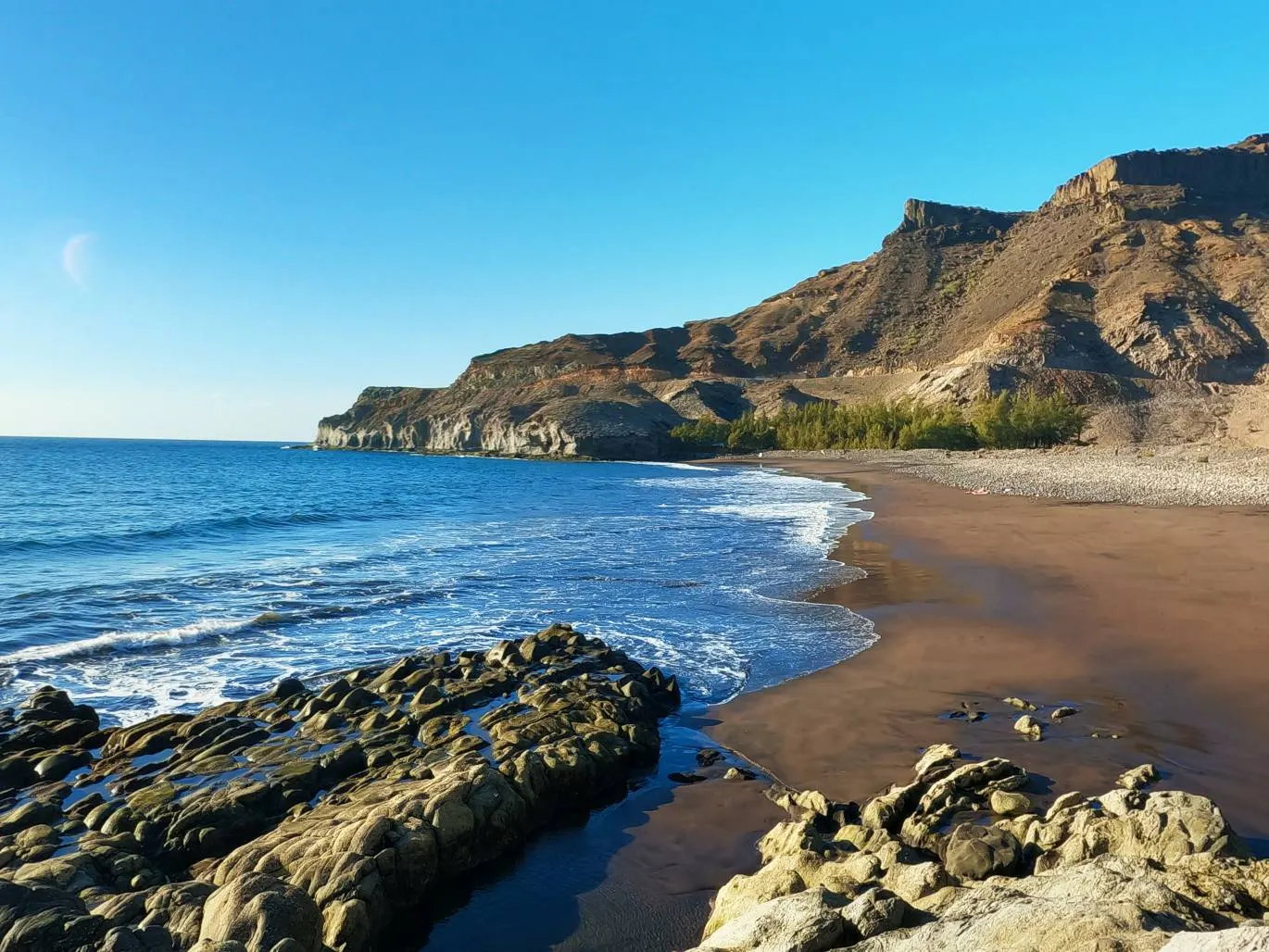
Puerto de Mogán from the air, with its harbour and beach.The turquoise bay at Anfi del Mar.Veneguera, a pebble beach with nothing built on it.
Puerto de Mogán
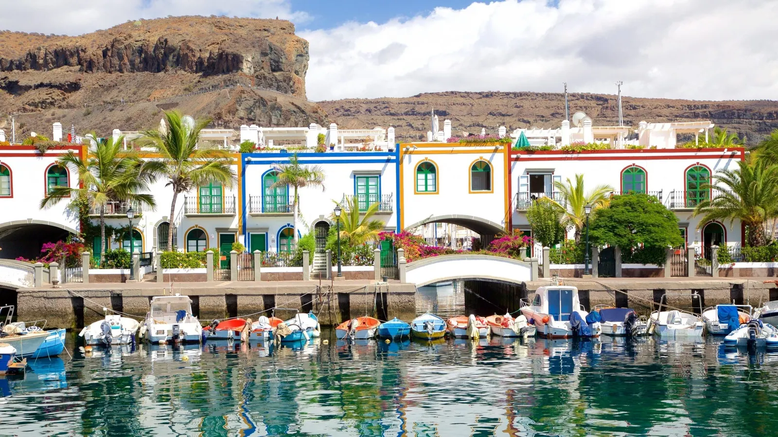
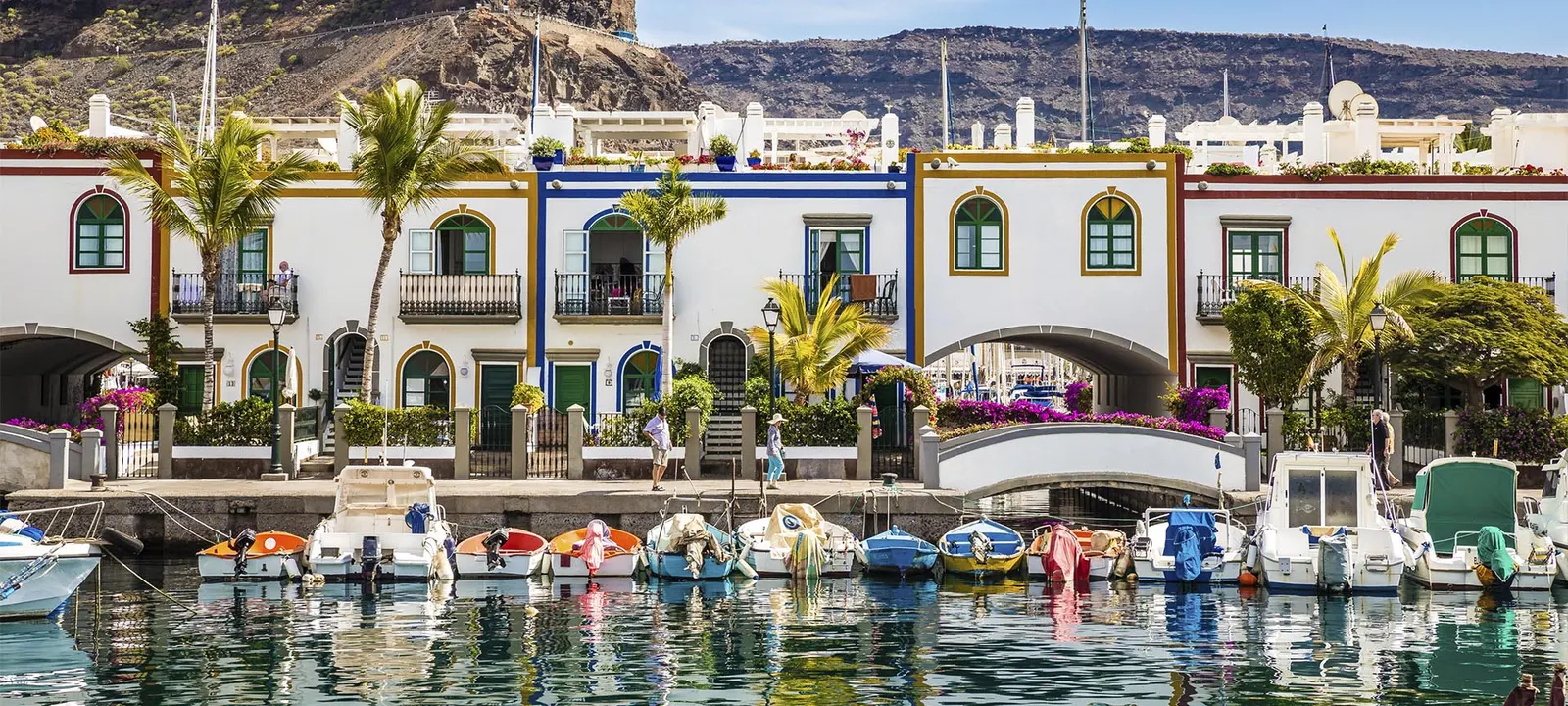
This is the postcard and the reason most people come this far west. A pedestrian core of whitewashed two-storey houses cut through by canals, with a marina on one side and a still-working fishing harbour on the other. They call it Little Venice, and while the nickname is pure brochure, the comparison is not absurd.
The commonest mistake is visiting between eleven and four, which is exactly when the organised excursions from the south converge on it. At eight in the morning or seven in the evening it is a different town.
We have a full guide to Puerto de Mogán covering where to stay, where to eat, the Friday market and what time to do each thing.
Right beside the beach there is a stop almost nobody makes that changes how you see the village: the Cañada de los Gatos, a pre-Hispanic archaeological site with stone houses and burial grounds, proof that this ravine was lived in centuries before the canals and the yachts. It opens Tuesday to Sunday (in summer, April to September, 10am to 6pm; in winter until 5pm), closed Mondays, general admission 4 € (reduced 2 €). Half an hour well spent between swims.
Arguineguín is the closest thing to an ordinary town left on this coast: a working pier, a long promenade and a neighbourhood life that disappeared from its neighbours decades ago. It is also where you eat best for the money anywhere in the municipality.
Its big day is Tuesday morning, when the market takes over the area around the harbour. A good share of the south coast’s whale-watching trips also leave from here.
The working fishing harbour at Arguineguín.
Amadores and Taurito
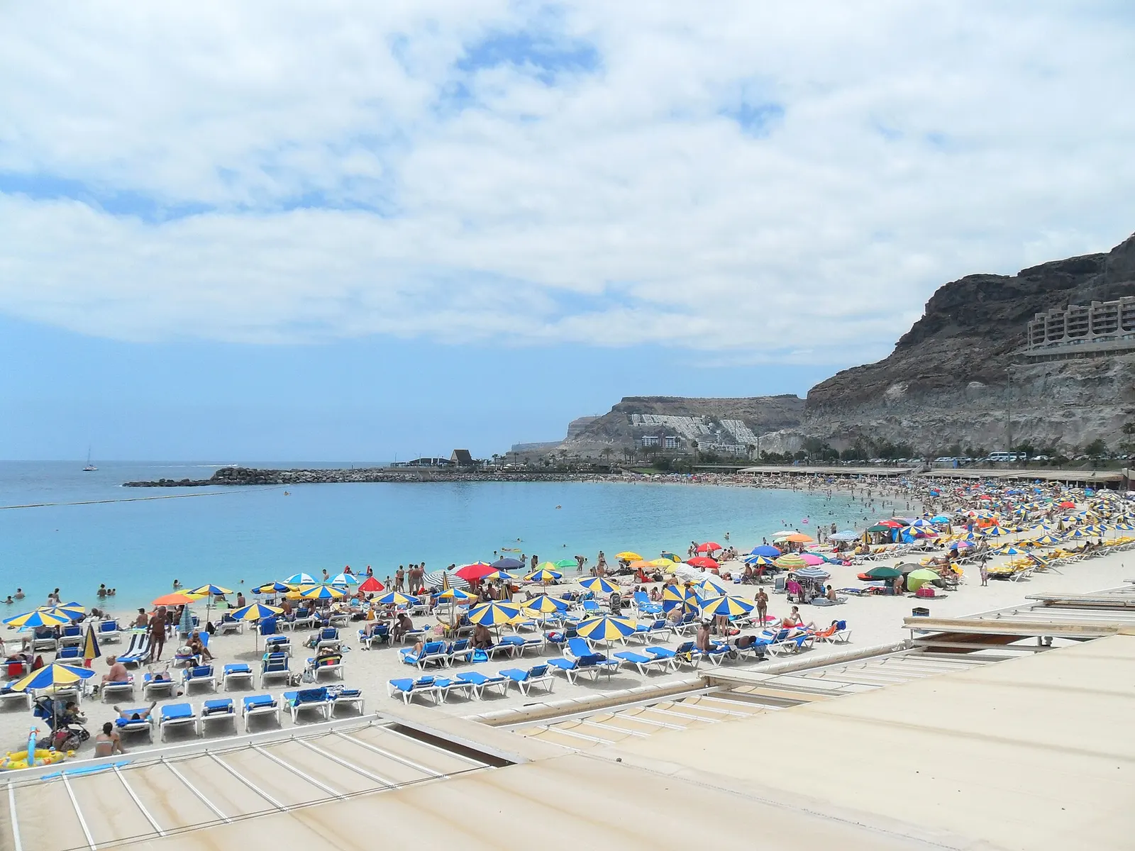
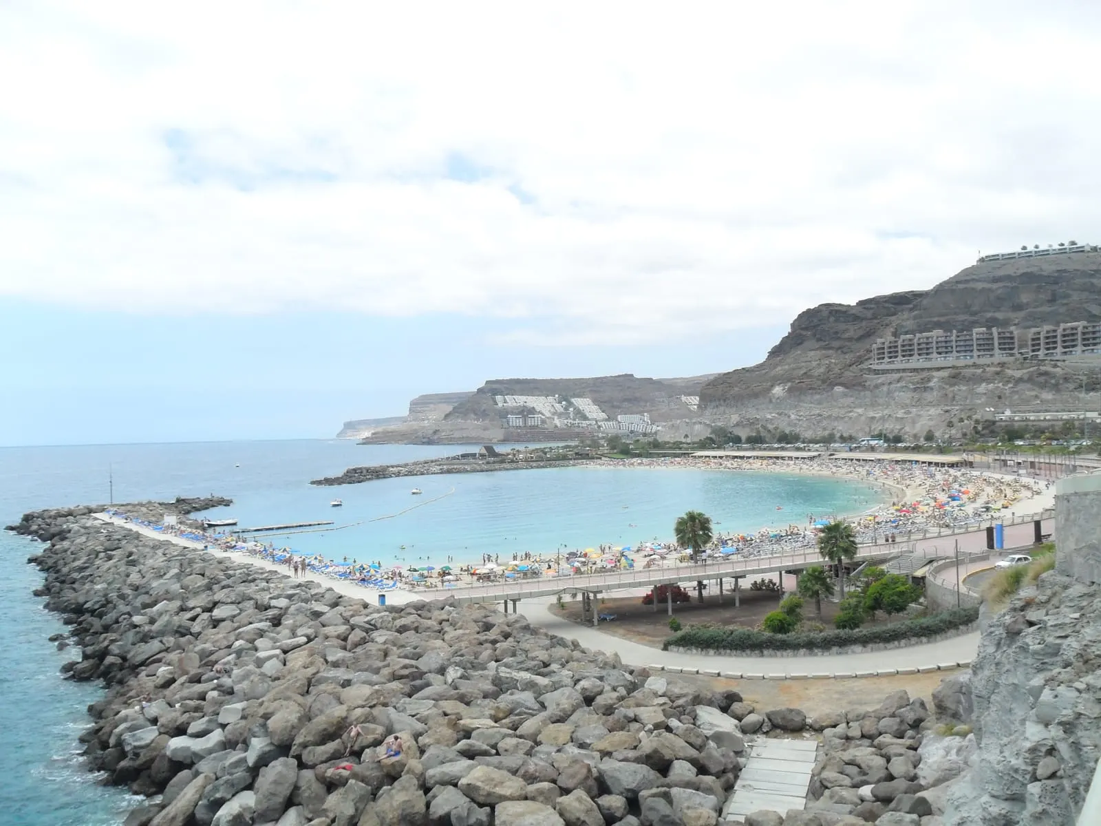
Amadores is an artificial bay of pale imported sand, completely closed off by two breakwaters. That makes it the safest beach in the municipality for small children: no waves, no current and a gradual entry into the water. The trade-offs are that it fills up and that nothing about it is natural.
The pale sand and promenade at Amadores.
Taurito is the opposite: a closed valley with a dark volcanic-sand beach (and a moderate swell the breakwaters do not fully cancel), fewer people, and a saltwater pool complex that comes into its own when the sea is rough.
Inland, the half almost nobody sees
This is the difference between having been to Mogán and having been to the coast of Mogán. Climbing the ravine from Puerto de Mogán, the road crosses into a landscape in twenty minutes that has nothing to do with the one below: deep gorges, reservoirs, palm groves and scattered hamlets.
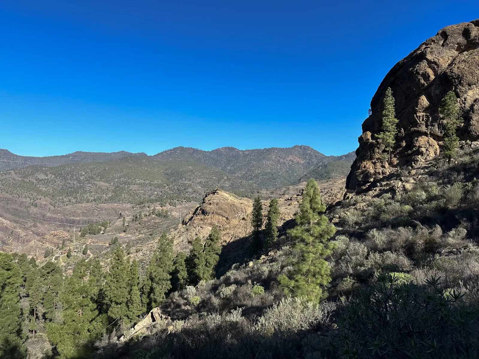
The mountainous interior, without a scrap of shade.
Mogán village
Nine kilometres from the coast sits the village that gives all this its name, still holding the air of the farming district the whole area was before tourism. Low houses, allotments, mangoes and avocados. It takes a good hour to see and it is worth it precisely because it is not set up to be seen.
One figure from the climate records worth carrying with you: the village runs about a degree warmer by day and rather more than a degree colder at night than the coast, because it loses the moderating effect of the sea.
A few metres from the centre, beside the road, stands the Molino Quemado, a mid-19th-century watermill that was the largest historic flour mill on Gran Canaria. It is known as “Quemado” (Burnt) because it went up in flames more than a century ago, and it is a listed Bien de Interés Cultural (ethnological site). Restored and reopened in 2025 as a cereal interpretation centre, it explains how grain was milled here when this was farming country rather than tourist coast. It is the best single stop for understanding the old Mogán.
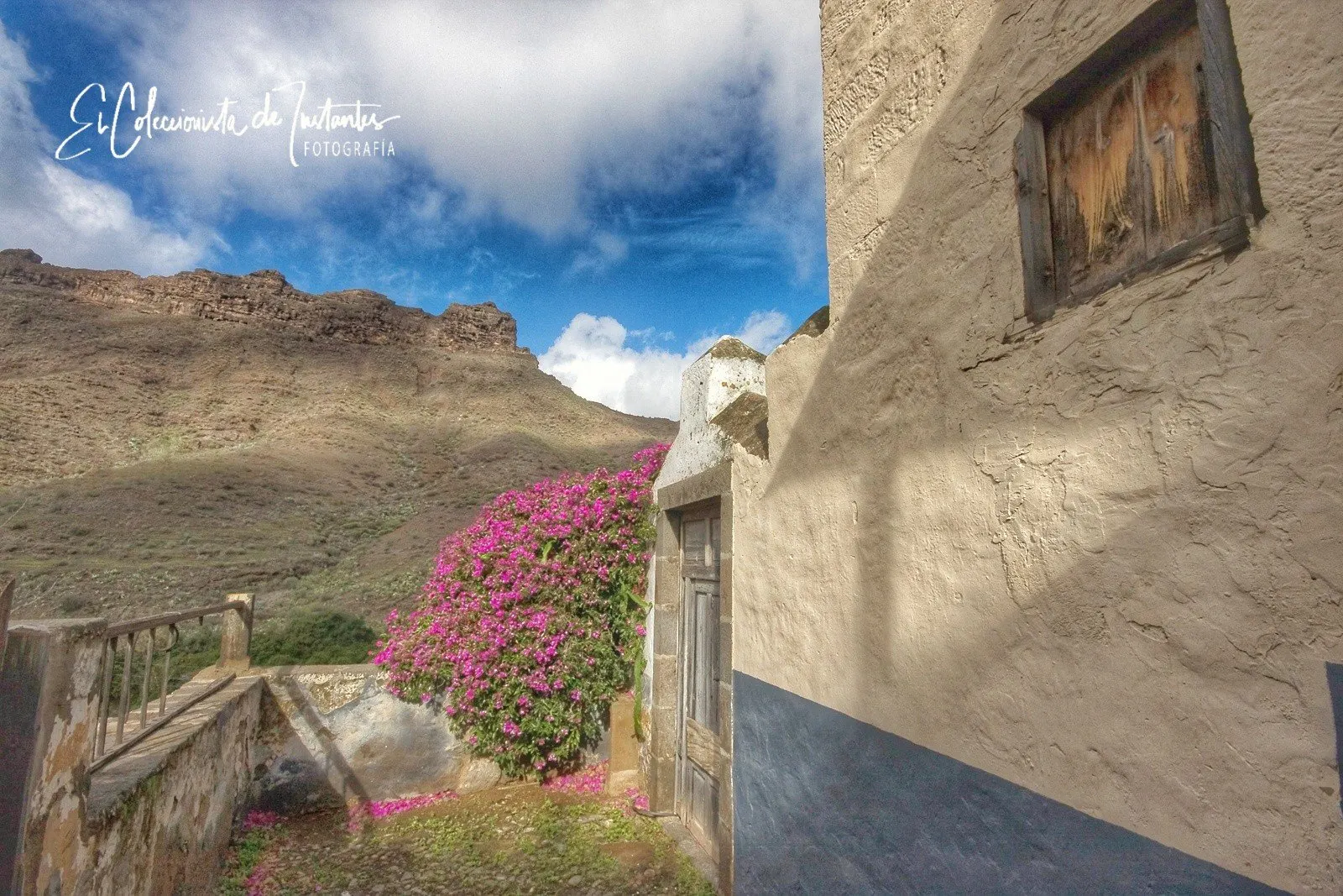
A whitewashed wall with bougainvillea in Mogán.
The reservoirs, the landscape nobody expects
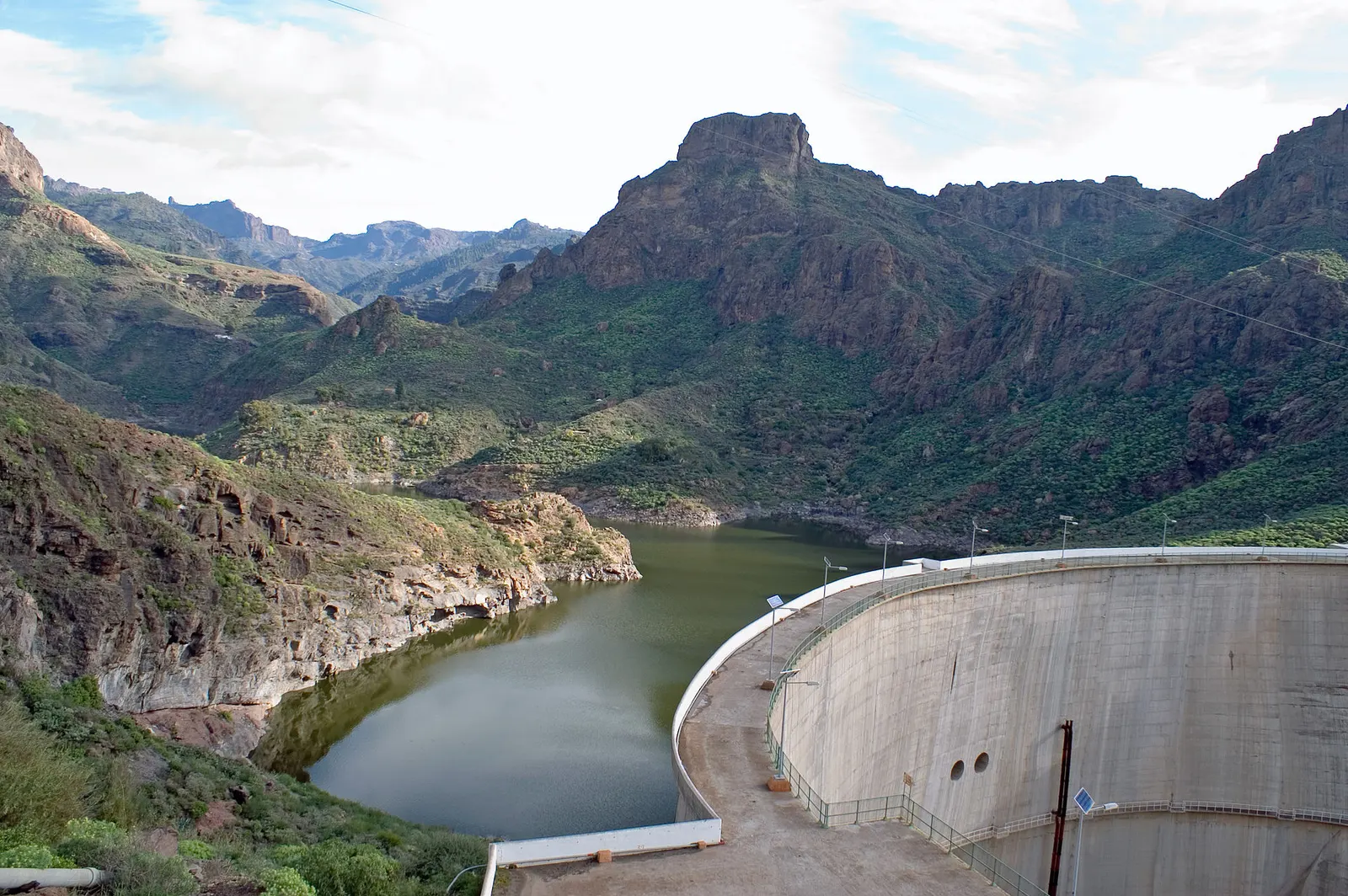
The interior of Mogán also holds one of the most spectacular hydraulic landscapes in Gran Canaria, with several large reservoirs wedged between rock walls: green water, without a parasol in sight. The biggest is Presa de Soria, already in the Barranco de Arguineguín basin (the upper stretch is called Barranco de Soria), between Mogán and San Bartolomé de Tirajana. It is the largest reservoir in the Canaries by height and nominal capacity (a wall around 120 m high and of the order of 32 hm³), though it is worth saying it has never actually filled completely and usually sits well below that. The detour earns its place for the contrast with the coast you left below.
Presa de Soria, wedged between rock walls.
The La Aldea road
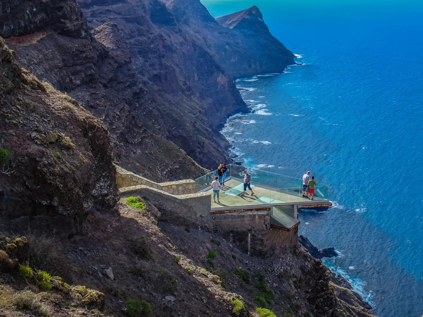
Heading north from Puerto de Mogán, the GC-200 towards La Aldea de San Nicolás is one of the most spectacular roads in the Canaries and one of the most demanding: continuous bends, cliffs dropping straight into the sea and miradors every few kilometres. It is not for anyone who suffers from travel sickness, and not for anyone in a hurry.
The El Balcón mirador, just over the boundary in the next municipality, is where nearly everyone stops. It is worth every minute.
On the way, around kilometres 41 to 50 of the GC-200, the mountainside reveals the Fuente de Los Azulejos: a wall of volcanic rock stained green, turquoise and ochre. It is not the same phenomenon that turns Barranco de las Vacas orange (there it is erosion and iron oxidation); here the colour comes from a hydrothermal alteration tied to the fault of the old Tejeda caldera, and it is listed as a Geological Heritage Site. There are lay-bys along the road and the stop takes ten minutes.
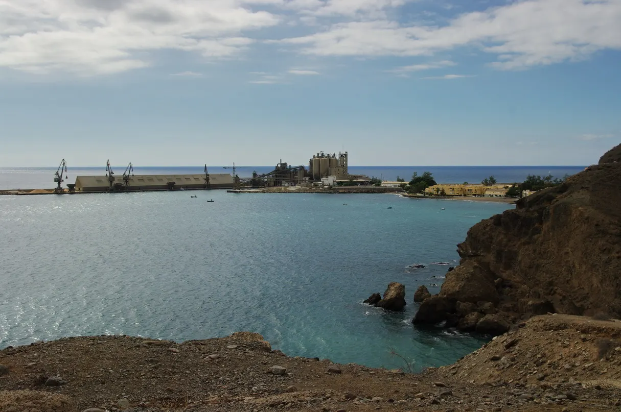
West of Taurito the coast stops being developed. Veneguera is a beach of pebble and dark sand with no facilities of any kind: no bar, no shade, no lifeguard, and a final stretch of track that is uncomfortable in a small car. Which is exactly why it is still empty.
Veneguera, a pebble beach with nothing built on it.
It is the place to go if you want to see what this coast looked like before tourism. Take everything you will need, water included.
For walkers, the interior is serious hiking country: ravines, palm groves and the protected pine forests of the Inagua Integral Nature Reserve at the head of the municipality. There are routes at every level, from valley-floor strolls to demanding climbs into the uplands. It is not a flip-flops plan: proper footwear, plenty of water and an early start, because up here there is no shade and no services. If it is your first time, hire a guide or check the state of the paths before setting off.
If you head inland in summer, set off before nine and carry water and a hat. There is not a scrap of shade on the ravine paths, and the coastal forecast will understate what you are walking into by more than a degree.
What you can only see from the water
The cliffs along this stretch are invisible from the road. They open up only from the sea, and that is the real reason to get on a boat here, quite apart from the trip itself.
There are two ways to do it. The cheap, practical one is the express boat linking Puerto Rico, Arguineguín and Puerto de Mogán: it costs very little, works as transport, and shows you the coast on the way. The other is a dedicated whale and dolphin trip: these waters hold bottlenose dolphins and short-finned pilot whales year-round, and sightings are common.
The advice from people who sail daily: book the morning. The sea is flatter, the animals are more active, and far fewer people are seasick.
Puerto de Mogán from the air: low-rise, compact and walkable.
Using Mogán as a base: day trips
Mogán works very well as a base camp for the rest of the island, and that is a reason to stay here that rarely makes the brochures. Not everything is “next door”, but all of it is within comfortable day-trip range:
Desliza para ver la tabla completa →
Destination
From Puerto de Mogán
What it is
Time to allow
Roque Nublo
1h 15
The island’s symbol, at 1,800 m
A long half day
Tejeda
1h 10
Summit village, one of Spain’s prettiest
Half a day
Maspalomas
30 min
The dunes and the big southern beach
Half a day
Las Palmas
1h 15
City, old quarter and Las Canteras beach
A full day
La Aldea
1h
The most spectacular road on the island
Half a day
Agaete
1h 20
Natural pools and the coffee valley
Half a day
Roque Nublo above the summit plateau.
The contrast is what makes basing yourself here interesting: in under ninety minutes you go from a beach at 26° to a summit at 1,800 metres where winter is genuinely cold. Very few visitors take advantage of that.
When to come, and what time to go where
The answer to “when should I come” is dull: whenever you like. There are 7,3 degrees between the warmest month and the coolest, so there is no climatic off-season here at all.
Temperature month by month
Average daily high and low. Hover any month for detail.
20.4°
15.8°Jan
20.6°
15.8°Feb
21.6°
16.2°Mar
22°
16.7°Apr
23.2°
17.7°May
24.7°
19.1°Jun
26.8°
20.6°Jul
27.7°
21.6°Aug
26.6°
21.4°Sep
25.6°
20.7°Oct
23.5°
19°Nov
21.5°
17.1°Dec
highlow
Warmest: August 27.7°Coolest: January 20.3°
Climate normals 1991–2020, Open-Meteo (EC-Earth3P-HR model) for 27.82°N, 15.76°W.
For a British visitor the comparison that matters is with the alternatives. These are real December-to-February averages from the last ten years:
Desliza para ver la tabla completa →
Destination
Winter daytime average
Rainy days per month
Flight time from the UK
Mogán, Gran Canaria
21,4°
2,4
About 4h 30
Costa Adeje, Tenerife
21,2°
2,0
About 4h 30
Marrakech
20,6°
4,5
About 3h 30
Funchal, Madeira
18,9°
9,3
About 4h
Málaga
17,2°
5,2
About 3h
Paphos, Cyprus
16,8°
10,9
About 4h 30
The interesting question is not the month but the hour. Mogán’s coastal towns are a fixed stop on the organised excursion circuit, and that squeezes the crowds into a very narrow window:
How the coast fills up through the day
8am
EmptyFlat sea, no wind, the best light of the day. The catch coming in at the harbour.
11am
The coaches arriveExcursions start coming in from Maspalomas and Playa del Inglés.
1pm
PeakTerraces full, canals busy, car parks at capacity.
4:30pm
It empties outThe excursions head back to the hotels.
7pm
The best hourWarm light on the whitewash, quiet terraces, the harbour to yourself.
If you can only come once, come first thing or at sunset. For the full weather picture, including a live forecast, we have a Mogán weather guide.
23°
Puerto de Mogán · Now
Mostly sunny
Humidity 78%Wind 7 km/h
Next 7 days · tap a day for hourly detail
Today8 Oct26°23°55%
HourTempRainWindUV
09:0023°0%5km/h0
12:0025°0%10km/h5
15:0026°28%14km/h5
18:0025°43%10km/h2
21:0024°0%4km/h0
Tomorrow9 Oct25°21°15%
HourTempRainWindUV
09:0022°0%6km/h0
12:0025°0%8km/h5
15:0025°8%13km/h4
18:0024°13%10km/h2
21:0024°8%5km/h0
Sat10 Oct26°21°8%
HourTempRainWindUV
09:0022°0%7km/h0
12:0025°0%9km/h5
15:0026°3%11km/h5
18:0026°8%9km/h2
21:0024°5%4km/h0
Sun11 Oct25°22°20%
HourTempRainWindUV
09:0023°2%1km/h0
12:0025°0%10km/h5
15:0025°6%13km/h7
18:0025°19%12km/h2
21:0024°17%5km/h0
Mon12 Oct26°21°5%
HourTempRainWindUV
09:0023°0%5km/h0
12:0026°0%8km/h5
15:0026°0%12km/h4
18:0025°0%10km/h1
21:0024°0%4km/h0
Tue13 Oct27°21°0%
HourTempRainWindUV
09:0023°0%4km/h0
12:0026°0%8km/h5
15:0026°0%12km/h7
18:0025°0%7km/h3
21:0025°0%3km/h0
Wed14 Oct29°23°3%
HourTempRainWindUV
09:0025°0%1km/h0
12:0028°0%7km/h5
15:0029°0%8km/h7
18:0029°1%5km/h3
21:0027°2%6km/h0
Live forecast from Open-Meteo for Puerto de Mogán, updated hourly. Weather models work on a grid of roughly 10 km, so the coastal towns of the municipality share the same cell: the figures for Puerto de Mogán, Puerto Rico and Arguineguín are effectively the same forecast, adjusted for altitude. Inland Mogán village is a separate cell and does differ.
Every beach, compared
The main beaches of Mogán, from east to west, and none resembles the one next to it. This is the honest comparison:
Desliza para ver la tabla completa →
Beach
Sand
Surf
Facilities
Best for
Amadores
Pale, imported
None
Full
Young children and windy days
Puerto de Mogán
Golden
Very gentle
Full
Combining beach and town
Puerto Rico
Golden, imported
Gentle
Full
A beach day with everything to hand
Taurito
Dark volcanic sand
Moderate
Good
Fewer people and pools
Arguineguín
Pebble
Gentle
Basic
Local atmosphere
Veneguera
Pebble and dark sand
Strong
None
Nature with nobody in it
Sea temperature month by month
The monthly averages for 2016-2025 range roughly between 20.2° in February and 24.1° in September, so the swimming season here never really closes.
Jan20.8°
Feb20.2°
Mar20.2°
Apr20.7°
May21.5°
Jun22.7°
Jul23.3°
Aug24.1°
Sep24.1°
Oct23.8°
Nov23.1°
Dec21.8°
23° and up: warm21.5-23°: fresh at firstBelow 21.5°: bracing
Daily average 2016-2025 off the Mogán coast, Open-Meteo Marine.
These averages, taken off the Mogán coast, run from about 19-20° in the cool months to around 24° in August and September. The swimming season never actually closes here, though from December to May the first minute is an exercise in willpower. It is a south-west reference; on the north and east of the island the water feels a little cooler.
Eating well without falling into the trap
The rule holds across the whole south of the island and Mogán is no exception: the further back from the seafront you go, the better you eat and the less you pay. Two or three streets inland changes both the menu and the bill, and that is where local people eat.
With fish there is one trick that always works: instead of ordering from the menu, ask what came in today. The harbours at Arguineguín and Puerto de Mogán still land a catch and the answer changes daily. A vague reply tells you what you need to know.
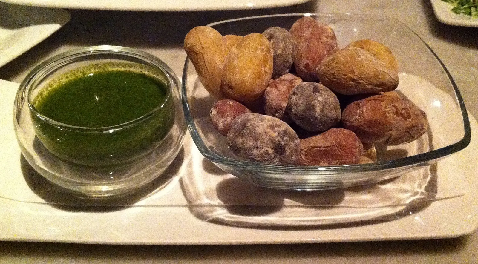
Three dishes that genuinely belong here rather than to the tourist menu: sancocho canario (salt fish with potatoes and gofio), proper papas arrugadas con mojo, and any local fish grilled whole, usually parrotfish, sea bream or wreckfish.
It depends entirely on your plan, and the honest answer is that you do not always need a car.
You do not need a car if…
Your plan is beach, promenade and dinner
You are staying in one coastal resort
You intend to use the boat between Puerto Rico and Mogán
You are happy with the bus, which is frequent and cheap
You would rather not fight for a parking space in high season
Hire a car if…
You want to go inland or up the ravine
You plan to reach Veneguera or drive the La Aldea road
You are taking day trips to the centre of the island
You are travelling with children and a lot of beach kit
You are staying away from the resort where you plan to spend the day
One point almost no guide makes: the interior is served by bus, just infrequently. Global line 84 links Puerto de Mogán with Mogán village up the ravine and its hamlets (Cruce de Mogán, El Hornillo, Los Navarros…), and line 38 climbs the GC-200 towards La Aldea, passing Veneguera and Tasarte. They do not replace a car for a flexible day of ravines and reservoirs, but they will get you to the village or near Veneguera without driving. Check times on the Global site, as these lines run only a few services a day.
On parking, one warning that saves a lot of frustration: the centres of the coastal towns fill up by late morning in season. Park up the hill and walk down: the walk is five minutes and it costs a great deal less than twenty minutes of circling.
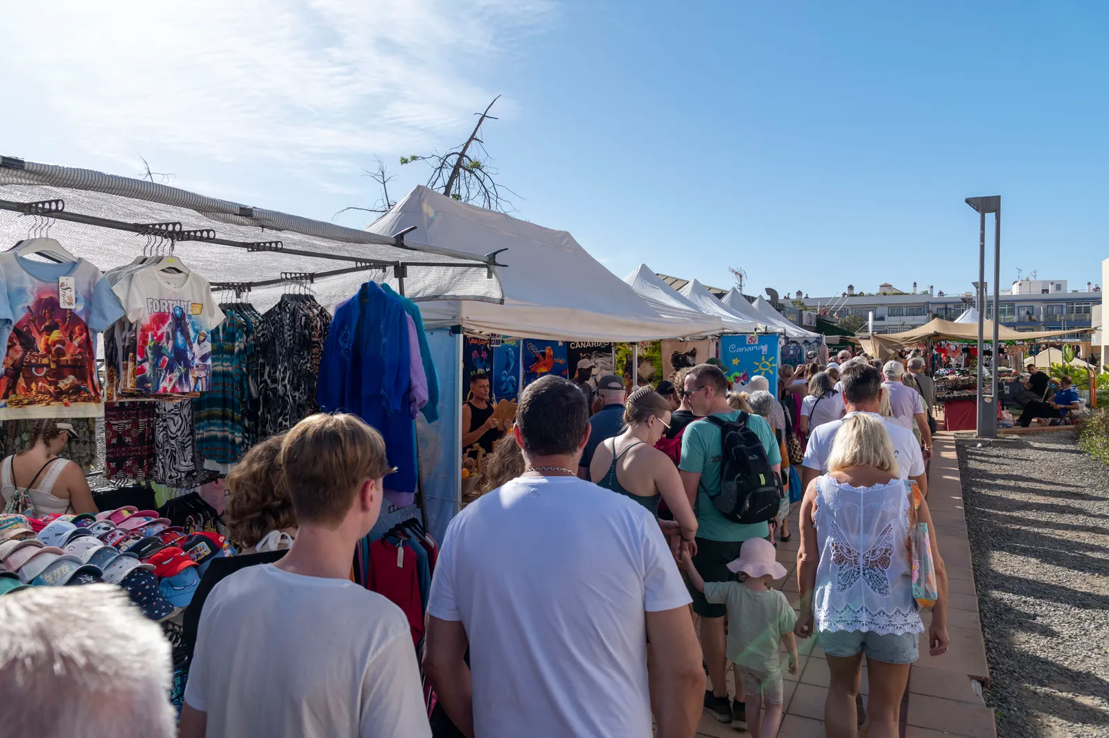
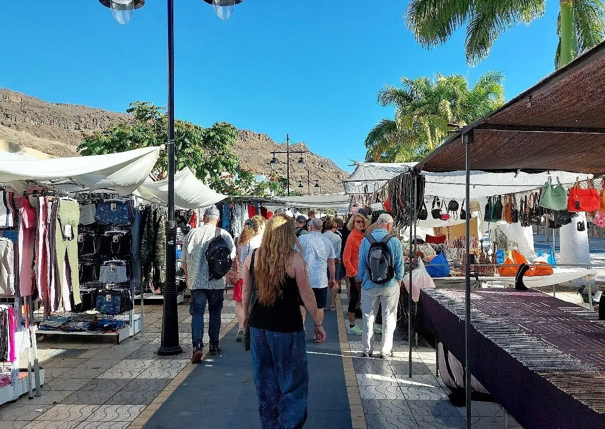
The markets, day by day
Each town has its own and they draw big crowds. It is worth knowing which falls within your dates, whether you want to go or would rather avoid it:
Desliza para ver la tabla completa →
Day
Where
What to expect
Tuesday morning
Arguineguín
The largest in the municipality, beside the harbour
The advice is the same in both cases: arrive before ten. The stalls are set up and the excursion coaches have not turned up yet.
The six mistakes we see every week
Coming at midday. It is the worst window of the day in every coastal town. First thing or at sunset it is literally another place.
Staying only on the coast. Inland is half the municipality and it is the half people remember years later.
Eating on the seafront. Worse menus and higher prices than two streets back.
Not booking the boat for the morning. Flatter sea, more active animals and far less seasickness.
Driving into the town centre at peak hour. Park up the hill and walk down.
Skipping sun cream in winter. The UV index still sits at 5 or 6 in January and the breeze hides it completely.
Common questions
How many days do you need for Mogán?
One day covers the coast or the interior, not both. Two days shows you the essentials of the municipality. With a week you can use Mogán as a base and explore the rest of the island.
What is the most beautiful part of Mogán?
Puerto de Mogán at sunset is the short answer and the one nearly everyone gives. The less obvious answer is the ravine road up to the village and on towards La Aldea, a landscape with no connection to the coast at all.
Which is the best beach?
It depends who you are with. Amadores for young children, because it has no swell. Puerto de Mogán if you want to combine beach and town. Veneguera if you want nature and do not mind that there is absolutely nothing there.
Do you need a car in Mogán?
No, if your plan is beach and promenade in one resort: the coastal bus is frequent and the boat links Arguineguín, Puerto Rico and Puerto de Mogán. The interior is reachable by bus too (line 84 to Mogán village, line 38 towards Veneguera and La Aldea), but with only a few services a day; to roam the ravines and reservoirs freely, a car is better.
When are the markets?
Tuesday morning in Arguineguín and Friday morning in Puerto de Mogán. They are the busiest days of the week in each place.
What is the best time of year to visit?
Any, with seven degrees between the warmest and coolest month. If you can choose, May and October are the two where good weather, warm water, thin crowds and sensible prices all coincide.
Can you swim in winter?
Yes. The sea sits at 20-21° from December through May. It is cool on entry and comfortable once you are in, and there are swimmers every day of the year.
Is Mogán worth it if I am staying in Maspalomas?
Yes, and it is thirty minutes by car. What is not worth it is the organised mid-morning excursion, because it drops you here in the worst window of the day.
In short
Mogán works very well once you understand it is two places in one. Below, a coast of resorts with beaches for every taste and a canal village that has thoroughly earned its place on the covers. Above, a farming municipality of ravines and reservoirs that almost nobody climbs to.
If you take one idea from this guide, make it the one about timing: the difference between a memorable visit and a disappointment is not the place, it is the hour. Outside the midday window, the town recovers the pace it had before the coaches started coming.
And if you are visiting from elsewhere on the island with a single day for the south-west, the combination that works is simple: arrive early at the harbour, give the morning to the town and the beach, eat two streets inland and keep the afternoon for a boat trip. You go home with the best of the coast and without having stood in the worst part of the day.
Image credits
Gess · CC BY-SA 3.0 · vía Wikimedia Commons · Frank Vincentz · CC BY-SA 3.0 · vía Wikimedia Commons · Bgabel · CC BY-SA 3.0 · vía Wikimedia Commons · sailko · CC BY-SA 3.0 · vía Wikimedia Commons · El Coleccionista de Instantes · CC BY-SA 2.0 · vía Wikimedia Commons · Guido (subida original) · CC BY-SA 2.0 de · vía Wikimedia Commons · Wikimedia Commons · CC BY-SA · vía Wikimedia Commons · Giuseppe Milo · CC BY 2.0 · vía Wikimedia Commons · Bengt Nyman · CC BY 2.0 · vía Wikimedia Commons · H. Zell · CC BY 3.0 · vía Wikimedia Commons · Abhay Kumar from San Francisco, CA, USA · CC BY-SA 2.0 · vía Wikimedia Commons
The critical eye behind every recommendation. A Canarian local and self-confessed foodie who knows every corner of Mogán. His mission: for every visitor to experience Mogán like a local.
Local Tip
From the heart of Mogán
“Mogán cannot be seen in a day because it is not one place, it is several. With a single day, pick either the coast or the interior and do it properly.”
How to get there and where to park, why the water is so calm and the sand so golden, the seafront walk to Puerto Rico, when to go to dodge the crowds, and which southern beaches to weigh it against.
Everything about Puerto de Mogán’s Friday market: opening hours, where it is, what to buy, how to get there, where to park and the boat trips to enjoy it without a car.
The seven-day forecast for Puerto de Mogán, average temperatures for every month, sea temperature, and an honest comparison with other winter-sun destinations.