Barranco de las Vacas: The Honest Guide to Gran Canaria’s Most Photographed Canyon
How to reach Barranco de las Vacas, where to park, when the light is best, and how to turn the twenty-minute stop into a full day with the Guayadeque caves and the Azulejos of Mogán.
Martín PazCanarian Resident · Foodie
Reviewed
Share
Barranco de las Vacas is the photo you have seen a hundred times: a passage of rippled orange and golden stone that looks airlifted from Arizona and sits half an hour from the southern beaches. The actual visit lasts twenty minutes, and that is both the trap and the opportunity: go only for the photo and you come back with twenty minutes; build the day around what surrounds it and you come back with one of the best inland days on the island. This guide is for the second option.
Barranco de las Vacas in short
What it is
A narrow passage of volcanic tuff sculpted by water
Where
Municipality of Agüimes, on the GC-550, near Temisas
How long
20-30 minutes for the canyon; a full day with Guayadeque
Cost
Nothing: it is an open ravine
Difficulty
Low: a short descent from the road, with uneven ground
Best light
Mid-morning, when the sun enters the passage
What it actually is (and why it looks like Arizona)
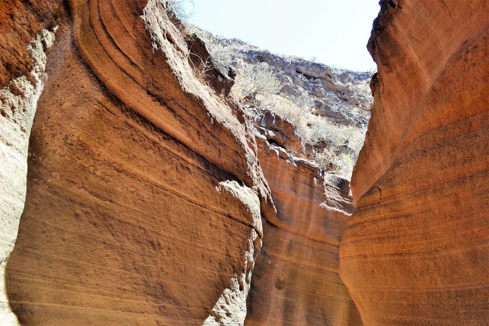
The famous corner is a short stretch of ravine where water has spent thousands of years polishing volcanic tuff, a soft rock of eruptive origin. The result is rippled walls veined in orange, pink and gold, a stone corridor that recalls the American slot canyons at Canarian scale: here the passage is crossed in a couple of minutes.
That does not make it minor. The short scale works in its favour: light bounces between the walls, changes with the hour, and the photos take themselves. You do not need to be a photographer or carry gear: a phone and the right hour are enough.
The tuff passage, polished by water over millennia.
Getting there and parking (the delicate part)
The ravine sits in the municipality of Agüimes, on the GC-550 road that climbs from Agüimes towards Temisas and Santa Lucía. From the southern beaches you reach it in 30-40 minutes; from Las Palmas, in about 40.
Now the important warning: there is no car park as such. You leave the car in the lay-bys on the shoulder and walk. On high-season weekends the spot fills up and spaces run out: one more reason to come early and midweek. From the shoulder, a short descent leads to the ravine bed, and the way into the passage goes under the road itself: you will know you are in the right place when you cross the tunnel and the stone starts to ripple.
The final stretch is a real ravine bed: uneven ground, loose stone and zero infrastructure. With decent soles it is a stroll; with flip-flops it is a twisted ankle. And the golden rule: the tuff is soft and every scratch stays forever. No names, no hearts, no initials.
By road, without traffic. Add a good fifteen minutes in high season.
DestinationKmTime
Agüimes7 km10 min
Guayadeque (entrance)10 km15 min
Maspalomas32 km30 min
Puerto Rico48 km40 min
Puerto de Mogán55 km45 min
Las Palmas38 km35 min
The geology in two minutes (to retell at dinner)
The veins have a simple, satisfying explanation: tuff is compacted volcanic ash and debris, far softer than the basalt of the lava flows. When the ravine carries water, which on this island is rare but emphatic, the current does not break the rock: it polishes it. Millennium after millennium, each flood rounds the walls a little more into this rippled corridor. The colours, from cream to deep orange, come from the oxidation of iron and the mineral variation between one ash layer and the next: each band is a separate deposit, which is why the wall looks like a cake of stacked tones.
Which is why the no-touching, no-scratching rule is not guide fussiness: the same softness that let water sculpt the passage lets a key or a coin mark it forever.
The photo, without being a photographer
Shoot from inside the passage towards the light, not the other way round: the ripples gain volume when light comes in at a low angle. Put someone in the frame, small, so the scale reads; without a human figure the walls look like a model. If the sun is high and burning the highlights, wait for a cloud or find the shaded stretch: tuff in open shade comes out more saturated than in direct sun. And the big secret is the usual one: patience between groups. Visitors arrive in waves, and between waves you get two minutes of empty canyon.
When to go: the hour rules
The good photo depends on the sun entering the passage, and that happens mid-morning: the window between 10 and 12 usually gives the best mix of light and shadow on the veins. At dawn the canyon is switched off, at midday it goes flat; in the afternoon the light leaves the walls early.
The other factor is people. Since the spot went viral, weekend midday peaks bring a queue for the photo. The winning combination is the usual one on this island: midweek and early. And a common-sense warning: if it has rained hard or is raining, a ravine bed is no place to be. Go another day.
The second stop: the Guayadeque ravine
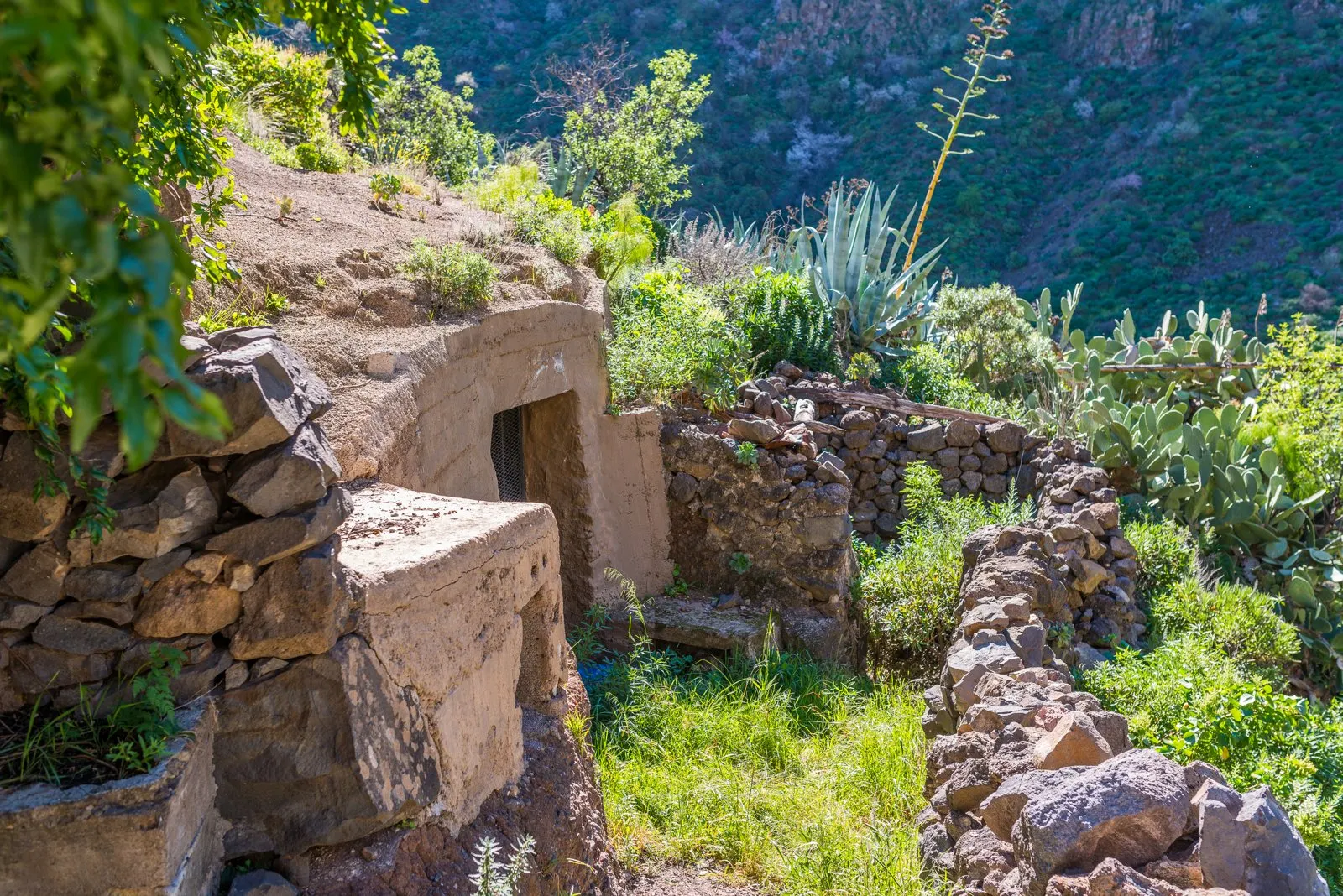
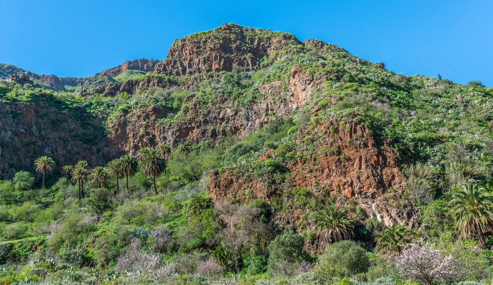
Fifteen minutes from the canyon is the mouth of the Guayadeque ravine, one of the most spectacular valleys in Gran Canaria and the reason this excursion deserves the whole day. Guayadeque is a green gorge between Ingenio and Agüimes with slopes stitched with caves: the ancient Canarians used them, and the villagers of the ravine hamlets still do, living in cave houses with whitewashed fronts and bare rock inside.
The cave houses of the ravine: whitewashed front, living rock inside.
The classic plan runs like this: stop at the Interpretation Centre at the entrance to understand what you are about to see (check opening days), drive up slowly stopping at the hamlets, visit the chapel carved into the rock, and finish at the cave restaurants at the end of the road, dining rooms set literally inside the mountain where the specialities are Canarian stews and grilled meat. Eating inside a cave with centuries of history is one of those things that pays for the whole trip.
The Guayadeque gorge: palms below, caves in the slopes.
A seasonal note: come between late January and February and the ravine fills with almond blossom, and the visit goes up a level. It is the locals’ favourite season, with good reason.
For walkers, the ravine also has waymarked trails climbing the slopes between caves and palm groves: you do not need them to enjoy the drive, but if your legs are asking, an hour up the trail from the hamlet area buys the best views of the gorge with far fewer people than the road. Ask at the Interpretation Centre about trail conditions before committing.
The sister stop in Mogán: Fuente de los Azulejos
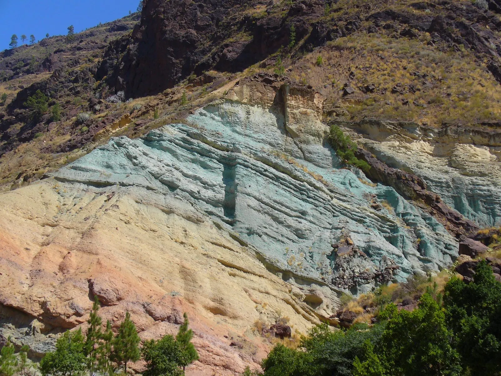
If you are staying in the southwest, note the home version: on the GC-200 from Mogán towards La Aldea, the mountainside shows a front of green and turquoise tuff, the Fuente de los Azulejos. Visually it is a close cousin of Las Vacas, another volcanic rock stained with colour, but the process is not exactly the same: here the green and turquoise come from a hydrothermal alteration of the minerals, not from the water-polishing and oxidation that give the Agüimes canyon its orange. Two spots that look alike in a photo and are explained differently. There are lay-bys along the road and the stop takes ten minutes, perfect on the way to Güigüi beach or the wild west.
The Azulejos: the green version, on the road from Mogán to La Aldea.
If you keep driving: Temisas
The GC-550 does not end at the canyon. Five kilometres further up appears Temisas, a stone hamlet hanging off the slope that claims, rightly, to be the olive corner of the Canaries: centuries-old olive trees terrace the slopes around the village, and a local oil is pressed and sold in the area. The hamlet takes twenty minutes to walk, the views to the east coast are enormous, and the stop turns the canyon road into a small inland route in three acts: tuff, olives and caves. If the day is running ahead of schedule, this is the detour that rounds it off.
Agüimes: the stop almost nobody makes
The usual mistake of the day is driving straight past Agüimes, and it is a textbook error: its old town is among the best restored in the Canaries, a calm maze of cobbled streets, earth-toned houses and sculptures scattered on the corners, with the bulk of the San Sebastián church (bare stone, small-cathedral air) presiding over the square. Half an hour of strolling and a coffee here turn the drive into part of the plan. It is literally on the way: the GC-550 to the canyon leaves from the town.
What to bring (and what you can skip)
The list is short but serious, because at the canyon there is nothing: closed shoes with grippy soles, water even if the plan is twenty minutes, a cap and sunscreen (zero shade), and a charged phone for the photos. No need for poles, hiking boots or gear: this is a short walk, not a route. If you continue to Guayadeque, add a light jacket: the ravine floor is cool even in summer, and inside the cave restaurants you will be glad of it.
The round day of the inland east
This is how it all fits from the southwest beaches, with the hours built around the canyon light and the cave lunch:
Las Vacas + Guayadeque in one day
9:00
Leave the southwest on the GC-1. Quick coffee in Agüimes, whose old town almost nobody visits and is a small gem.
10:15
Barranco de las Vacas with the good light. Photos, a walk along the bed, and back to the car unhurried.
11:30
Into Guayadeque. Interpretation Centre, then the slow drive up stopping at the hamlets and the cave chapel.
13:30
Lunch in a cave restaurant at the end of the ravine. Stews, grill and mountain-cool air.
15:30
Easy drive down. Energy left? Second stop in the old town of Agüimes; if not, straight back.
16:30
Back in the south: in time for the evening swim.
Prefer someone else to drive, and to add the corners this guide does not cover? The guided inland routes cover this same territory with vehicle and guide, and are the comfortable option if you would rather not hire a car that day:
The most singular photo of the island interior with zero technical effort
Pairs in the same day with Guayadeque, which is the real heavyweight
A genuine half hour from the southern beaches
The green version (the Azulejos) is at home, in Mogán
The improvable
Shoulder parking: awkward and scarce at peak hours
The canyon visit itself is short: without a plan around it, it feels thin
No shade, no services and patchy signal: full self-sufficiency
The midday crowds rob it of its magic
Common questions
Before you go
How long does Barranco de las Vacas take?
The passage itself, twenty or thirty minutes with photos included. Which is why this guide insists on building the day with Guayadeque: together they genuinely fill a day.
Does it cost anything? Do I need to book?
No and no. It is an open ravine, no ticket office, no timetable, no services. You arrive, park on the shoulder and walk.
Is it suitable for children?
Yes, supervised: the descent is short but the ground is uneven with loose stone. Pushchairs will not make it; children who walk confidently will, no problem.
What is the best hour for photos?
Mid-morning, between 10 and 12: that is when the sun enters the passage and lights the veins. And midweek, to skip the queue.
Can you get there without a car?
Badly. There is no reasonable public transport to the exact spot: the real options are a hire car, a taxi from Agüimes, or a guided inland route like the ones above.
Is Guayadeque worth it if I have already seen the canyon?
They are different, complementary experiences: Las Vacas is a spectacular twenty-minute photo; Guayadeque is an entire valley with caves, hamlets, a rock chapel and lunch inside the mountain. Together they make the round day.
Can you explore beyond the passage?
The ravine bed continues, but the spectacular stretch is the tunnel and the tuff. Beyond that it is an ordinary ravine with no marked trail: most people do the passage, the photos, and head back to the car.
Is it the same as the Fuente de los Azulejos in Mogán?
They look alike, both are coloured volcanic rock, but it is not the same process: at Las Vacas the water-polishing and iron oxidation dominate (oranges); at the Azulejos, a hydrothermal alteration turns the rock green and turquoise. They are also in different municipalities, Agüimes and Mogán.
In short
Barranco de las Vacas is twenty minutes of rippled stone that earn the detour, on two conditions: go mid-morning on a weekday, and do not go only for that. With Guayadeque and a cave lunch behind it, the Instagram stop becomes one of the best inland days in Gran Canaria. And if you are staying in Mogán, do not leave the island without the green version: the Azulejos on the La Aldea road.
One last practical note: if you travel by camper van, neither the canyon shoulder nor the Guayadeque road are places to overnight; the plan works just as well as a day trip from the coast, where the prepared areas are.
The critical eye behind every recommendation. A Canarian local and self-confessed foodie who knows every corner of Mogán. His mission: for every visitor to experience Mogán like a local.
Local Tip
From the heart of Mogán
“If you are staying more than three days, hire a car for two of them. Everything that makes Gran Canaria interesting beyond the resorts is inland, and the bus does not go there.”
How to get there and where to park, why the water is so calm and the sand so golden, the seafront walk to Puerto Rico, when to go to dodge the crowds, and which southern beaches to weigh it against.
How to get there and where to park, what the sand is really like, what the Tauro blowhole is and when it erupts, where the cave sits, where to eat without emptying your wallet, and which southern beaches to weigh it against.
Everything about Puerto de Mogán’s Friday market: opening hours, where it is, what to buy, how to get there, where to park and the boat trips to enjoy it without a car.