Playa de Tauro: The Complete Guide to the Beach, the Blowhole and the Cave
How to get there and where to park, what the sand is really like, what the Tauro blowhole is and when it erupts, where the cave sits, where to eat without emptying your wallet, and which southern beaches to weigh it against.
Cristopher OlivaLocal Mogán Explorer
Share
Playa de Tauro is one of those southern Mogán beaches people stumble onto almost by accident, halfway between Puerto Rico and Puerto de Mogán. It is wide, open and less built-up than its neighbours, with golden sand and zones of gravel and volcanic pebbles, and it has two things that keep it showing up on Google all year: a blowhole that spits water against the rocks and a cave right beside it. This guide covers what you actually need to know before you go, starting with the question everyone asks first: how to get there and where to leave the car.
The whole beach from the air, with the blowhole in the background. Video by the Videos Luismi channel.
Playa de Tauro at a glance
Where
Between Puerto Rico and Playa del Cura, Mogán municipality
From Puerto Rico
About 3 km, 6 minutes
From the airport
About 55 km, 45 minutes
Type of ground
Golden sand with zones of gravel and volcanic pebbles
Length
About 440 metres, very wide
Swell
Moderate; more exposed than Amadores
Parking
Dirt area beside the beach; best to arrive early
How to get there and where to park
It is the question that comes up most, so it goes first. Tauro is on the GC-500, the old coast road, not the motorway. Coming from the airport or Maspalomas you follow the GC-1 west, pass Puerto Rico and a couple of kilometres on the signed turn-off to the beach appears.
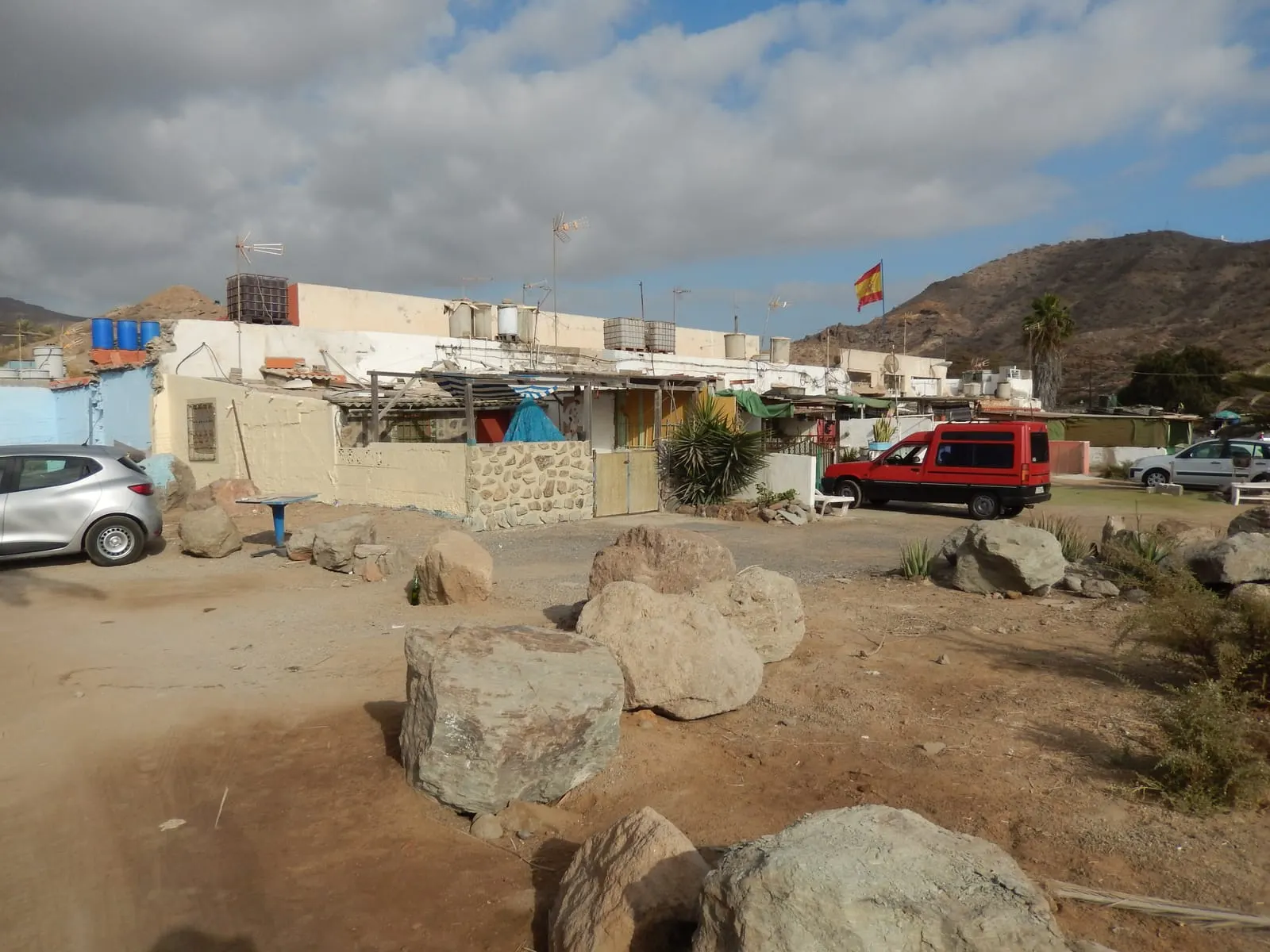
There is a dirt area beside the beach that most days lets you leave the car near the water, which is welcome in southern Gran Canaria. It is not surfaced or marked. In August or on a sunny Sunday it fills up, and there is also a small managed car park in the area, so it pays to arrive early and have a plan B. The exact arrangement of each zone can change over time, so check the signs on the ground.
By bus
If you have no car, Tauro has its own GLOBAL stop, called “Tauro”, up on the road, from which you walk down to the beach. Among the lines that stop there are the 1 (Las Palmas–Puerto de Mogán, via Puerto Rico and Amadores) and the 9 (linking Amadores, El Lechugal, Tauro, Playa del Cura and Taurito). Always check the official GLOBAL timetable before you set off, as it changes by season.
Walking to Tauro from Amadores
Many people visiting Tauro are staying in Amadores or Puerto Rico. By road it is about 3 km, but on foot there is no continuous flat promenade like the one linking Amadores with Puerto Rico: the most direct route forces you up to the road, with slopes and stretches with no pavement. It can be done, but with comfortable shoes, water and no rush. For most people the bus (line 9) or the car works out easier than covering it on foot.
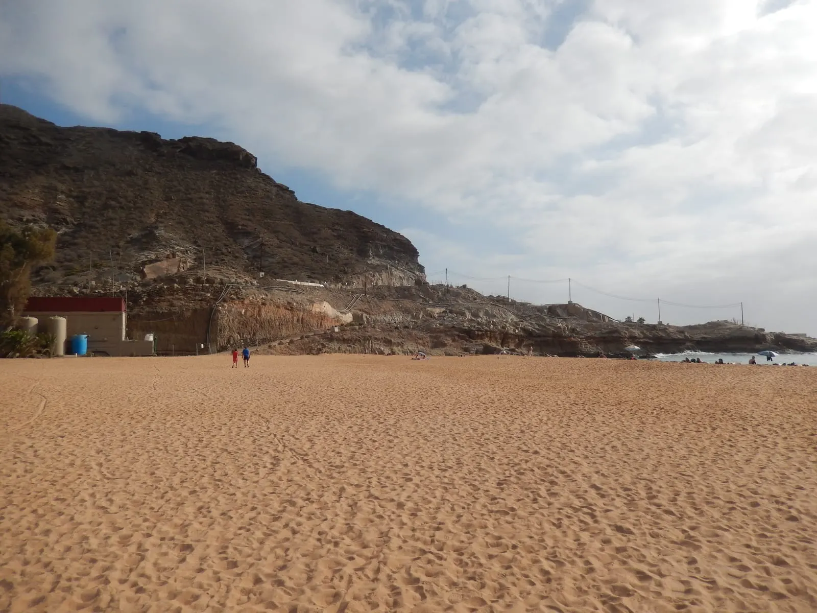
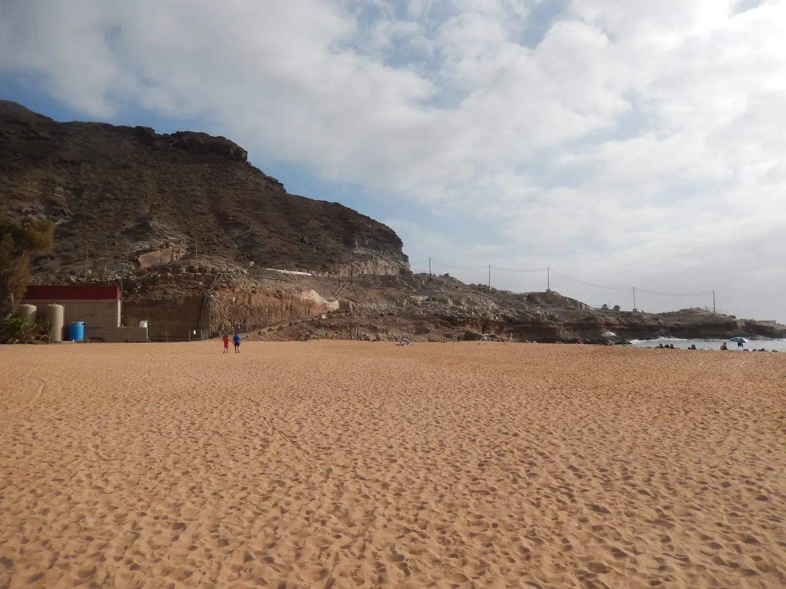
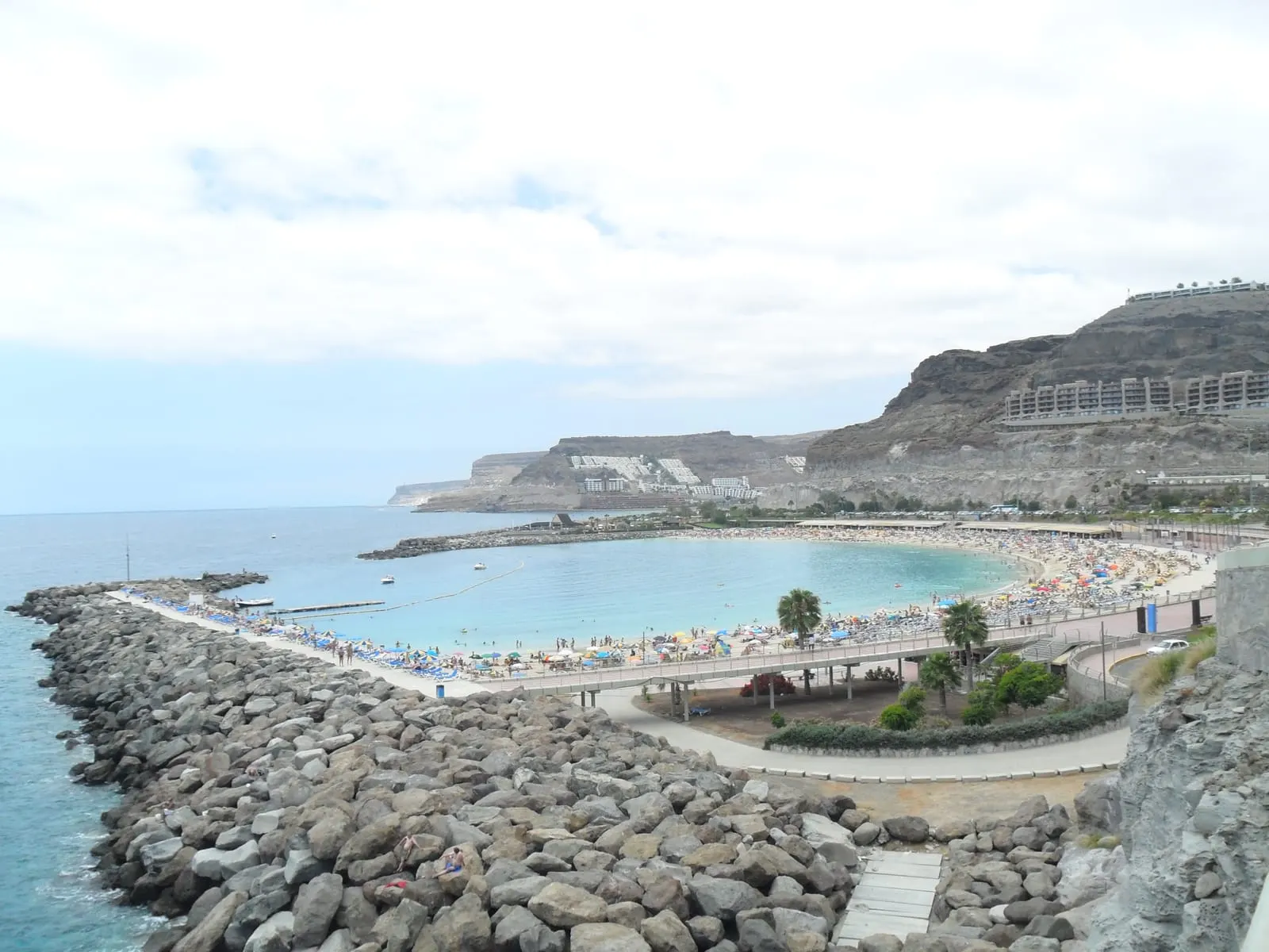
Playa de Tauro, wide and open, with the parking area behind.
Distances from Playa de Tauro
By road, without traffic. Add a good fifteen minutes in high season.
DestinationKmTime
Playa del Cura1 km3 min
Puerto Rico3 km6 min
Amadores3 km8 min
Anfi del Mar6 km11 min
Puerto de Mogán7 km12 min
Arguineguín8 km13 min
Gran Canaria Airport55 km45 min
What Playa de Tauro is really like in 2026
If you have seen old photos of Tauro covered in shingle and recent ones with golden sand, you are not looking at two different beaches: Tauro has changed a lot. It used to be a beach of shingle and volcanic stone, but in 2016 it was profoundly transformed with a major sand replenishment. Today it combines wide zones of golden sand with gravel and volcanic pebbles, especially in certain parts of the beach.
It is wide and long, with room to spare even on busy days, and noticeably less built-up than Amadores or Anfi. As it is not closed off by big breakwaters, it is more exposed: on calm days the swim is very pleasant, with little surf and a gentle slope, but it can get moderate swell, so it is worth checking the forecast on windy days or when there is a running sea.
Beach at a glance
Ground
Predominantly golden sand, with zones of gravel and pebbles
Swell
Moderate; more exposed than Amadores
Length
About 440 metres, very wide
Services
Seasonal; worth checking on the ground
With kids
Fine on calm-sea days; Amadores is more predictable
Parking
Dirt area beside the beach; arrive early
A useful note: in the gravel and pebble zones the ground is uncomfortable to walk on barefoot, especially with the hot stones at midday. If you land on that part of the beach, water shoes or flip-flops are welcome.
Why does Tauro have golden sand if it used to be shingle?
The answer lies in 2016. That year a major regeneration took place: around 70,000 tonnes of sand brought from the Sahara were added to transform the old shingle beach into the golden-sand beach you see today. Later research from the ULPGC documents that transformation. That is why Tauro does not quite fit the old “natural stone beach” label: it is a heavily modified beach, though still more open and less equipped than the artificial bays closed off by breakwaters like Amadores or Anfi.
Tauro Cave and Blowhole: what it really is
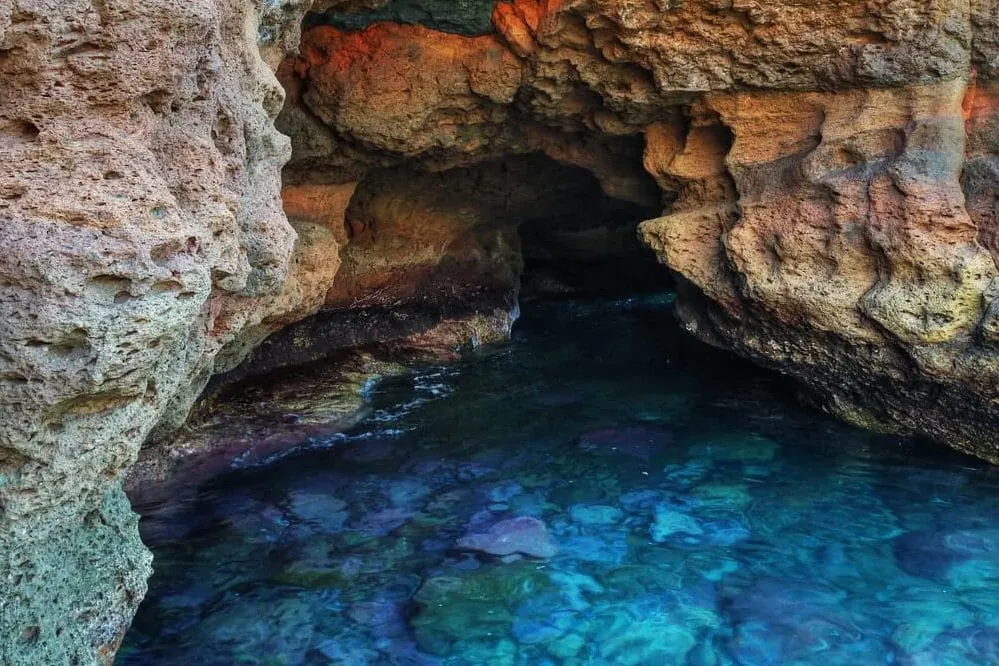
It is what most people look up about Tauro. On the side of the beach, up on the rocks, there is a volcanic rock formation that combines a blowhole (a hole through which the sea, coming in with force, spits water and foam upwards, with a snort you hear before you see it) and a cave connected to the sea that forms a kind of natural pool. They are not two separate attractions: they are expressions of the same formation.
The key, and it is the difference between enjoying it and getting a fright, is that what you want to do decides when to go:
Desliza para ver la tabla completa →
What you want
Conditions
Recommendation
See the blowhole blow
Running sea and high tide
Watch from a distance only; never go near the edge
Enter the cave/pool
Calm sea, low tide, little current and wind
Never when the blowhole is erupting
Put another way: to see the show the blowhole needs a moving sea, but then the area is dangerous and you must watch from afar. To enter the cave or the natural pool, the opposite: calm sea and low tide. The two do not happen at once, so decide what you are going to do before you go and check the sea and tide forecast.
The blowhole on a day of running sea, which is when you see it erupt.
The blowhole and cave sit on slippery, unrailed rocks. In a strong sea the jet comes out with force and the waves sweep the area without warning: enjoy it from a safe distance and never step near the edge for a photo. And if your plan is to enter the cave or the natural pool, only do so with a calm sea and low tide, never while it is blowing.
The beach, the surroundings and the blowhole rocks on foot. Video by the We Love Canarias channel.
Where to eat near Tauro
Tauro is an open beach, not a hub with lots of restaurants on the sand, and the situation of the venues on the beach itself changes over time, so here we prefer not to recommend blindly. What is certain is that Arguineguín, a quarter of an hour away, is where you eat best in the whole municipality, with fresh fish off the quay, and Puerto Rico and Puerto de Mogán are just as close. For a full beach day, many locals spend the morning at Tauro and head down to Arguineguín to eat.
Playa de Tauro from the side, on the way to the blowhole rocks.
Best time to go and water temperature
The advantage of this coast is that it has no bad season: southern Mogán is the sunniest, driest part of Gran Canaria, and at Tauro you can swim all twelve months of the year. The only thing that really changes is the sea temperature and how many people there are.
Sea temperature month by month
The monthly averages for 2016-2025 range roughly between 20.2° in February and 24.1° in September, so the swimming season here never really closes.
Jan20.8°
Feb20.2°
Mar20.2°
Apr20.7°
May21.5°
Jun22.7°
Jul23.3°
Aug24.1°
Sep24.1°
Oct23.8°
Nov23.1°
Dec21.8°
23° and up: warm21.5-23°: fresh at firstBelow 21.5°: bracing
Daily average 2016-2025 off the Mogán coast, Open-Meteo Marine.
For anyone planning a trip, the summary is simple: the water is cooler from February to April and milder from August to November, but never truly cold. And if you want the beach to yourself, you know the southern rule: before ten or after five.
22°
Tauro Beach · Now
Mostly sunny
Humidity 75%Wind 10 km/h
Next 7 days · tap a day for hourly detail
Today13 Oct26°21°0%
HourTempRainWindUV
09:0022°0%6km/h0
12:0025°0%8km/h5
15:0026°0%12km/h7
18:0025°0%7km/h2
21:0024°0%3km/h0
Tomorrow14 Oct27°22°0%
HourTempRainWindUV
09:0023°0%5km/h0
12:0026°0%7km/h5
15:0027°0%9km/h6
18:0026°0%6km/h2
21:0025°0%1km/h0
Thu15 Oct29°23°0%
HourTempRainWindUV
09:0024°0%5km/h0
12:0026°0%6km/h5
15:0029°0%9km/h6
18:0027°0%4km/h2
21:0025°0%1km/h0
Fri16 Oct28°24°0%
HourTempRainWindUV
09:0024°0%2km/h0
12:0027°0%6km/h4
15:0027°0%6km/h5
18:0027°0%4km/h2
21:0025°0%1km/h0
Sat17 Oct26°22°3%
HourTempRainWindUV
09:0024°0%2km/h0
12:0026°0%10km/h4
15:0026°0%13km/h6
18:0026°1%8km/h2
21:0024°2%2km/h0
Sun18 Oct28°20°3%
HourTempRainWindUV
09:0023°1%4km/h0
12:0027°0%3km/h5
15:0028°0%8km/h4
18:0025°0%6km/h2
21:0023°0%2km/h0
Mon19 Oct26°18°0%
HourTempRainWindUV
09:0021°0%3km/h0
12:0025°0%11km/h4
15:0026°0%14km/h4
18:0024°0%9km/h2
21:0022°0%8km/h0
Live forecast from Open-Meteo for Tauro Beach, updated hourly. Weather models work on a grid of roughly 10 km, so the coastal towns of the municipality share the same cell: the figures for Puerto de Mogán, Puerto Rico and Arguineguín are effectively the same forecast, adjusted for altitude. Inland Mogán village is a separate cell and does differ.
Who it is for and who it is not
You will like Tauro if…
You want a wide, open beach with no crush of sunloungers
You fancy parking near the sand, arriving early
You want to see the Cave and Blowhole, which other beaches do not have
You prefer a calm atmosphere to the resort beaches
You do not mind a less-equipped beach in exchange for space
Better another beach if…
You want the very sheltered turquoise bay with every service, that is Amadores or Anfi
You want lots of restaurants right on the beach
You are travelling with very young children and want maximum predictability
You mind the odd day of moderate swell
You have no car and do not want to rely on the bus
What to do nearby: the south-west sea
Tauro is right in the heart of Mogán’s bookable coast, so a beach day rounds off easily with a trip out to sea. From Puerto Rico, six minutes away, almost every boat trip in the area sets off, and many pass right in front of Tauro.
Dolphin and whale watching is one of the most rewarding: the south-west of Gran Canaria is among the best places in Europe to see them, and the trip runs along this whole coast, Tauro included. For anyone after something more leisurely, the fast ferry linking the southern harbours is a great plan that doubles as transport.
Southern Mogán is one beach after another, and each has its own character. This table helps you choose by what you are after that day:
Desliza para ver la tabla completa →
Beach
Ground
Vibe
Parking
Choose it if…
Tauro
Golden sand + gravel and pebbles
Open, calm
Dirt area, arrive early
You want space and the blowhole
Amadores
Light imported sand
Very busy, sheltered
Paid
You want the turquoise postcard
Anfi del Mar
White imported sand
Family, packed
Paid below
You are with small children
Playa del Cura
Sand and shingle
Local, quiet
On the street
You want somewhere even lower-key
The honest conclusion: Tauro is the choice for anyone who wants a wide, open beach, with its Cave and its Blowhole, and does not mind it being less equipped than the sheltered bays next door. If you want the protected turquoise water with all the services, Amadores is three kilometres away.
Frequently asked questions
Is Playa de Tauro sand or pebbles?
Today it is predominantly golden sand, with zones of gravel and volcanic pebbles in some parts. It was not always so: it was a shingle beach until it was regenerated with a major sand replenishment in 2016.
Why does Tauro have golden sand if it used to be shingle?
Because in 2016 it was transformed with around 70,000 tonnes of sand brought from the Sahara. Before that it was a beach of shingle and volcanic stone; later research from the ULPGC documents that change.
What are the Tauro Cave and Blowhole?
A volcanic rock formation on the side of the beach: a blowhole that spits water when the sea comes in with force, and a cave connected to the sea that forms a natural pool. They are part of the same formation.
When to see the blowhole and when to enter the cave?
To see the blowhole blow you need a running sea and high tide, but then you must only watch from afar. To enter the cave or the natural pool, the opposite: calm sea, low tide and never when the blowhole is erupting.
Can you walk from Amadores to Tauro?
On foot there is no continuous flat promenade like the one from Amadores to Puerto Rico; the route forces you up to the road, with slopes and stretches with no pavement. It is about 3 km. For most people the car or the bus (line 9) is easier.
How do you get to Playa de Tauro by bus?
GLOBAL has its own “Tauro” stop up on the road. Among the lines that stop there are the 1 and the 9. Check the official GLOBAL timetable before you set off, as it changes by season.
Can you park at Playa de Tauro?
There is a dirt area beside the beach that most days lets you park near the water, plus a small managed car park in the area. In August or on sunny Sundays it fills up, so it is best to arrive early.
Is it good for swimming all year?
Yes. Southern Mogán is the sunniest, driest part of the island and the water is never truly cold. That said, being a more open beach it can get moderate swell on some days.
In short
Playa de Tauro is the beach you pick when you want something wide and open, without giving up being ten minutes from everything. It has changed a lot, from shingle to golden sand after the 2016 regeneration, it is still less equipped than the sheltered bays next door, and in exchange it gives you room to spare even on busy days and two corners, the Cave and the Blowhole, you will not find on the imported-sand beaches.
If you take one idea from this guide: decide what you are going to do at the blowhole before you go. Watching it blow is from afar and with a moving sea; entering the cave is with a calm sea and low tide. And in summer, arrive early for the parking.
Image credits
Gerd Fahrenhorst · CC BY 4.0 · vía Wikimedia Commons · vía Villa Gran Canaria
A tireless explorer of every corner of Mogán. A lover of good coffee and an expert at finding the best fresh fish of the day. His motto: “In Mogán there's always something new to discover”.
Local Tip
From the heart of Mogán
“If you are staying more than three days, hire a car for two of them. Everything that makes Gran Canaria interesting beyond the resorts is inland, and the bus does not go there.”
How to get there and where to park, why the water is so calm and the sand so golden, the seafront walk to Puerto Rico, when to go to dodge the crowds, and which southern beaches to weigh it against.
Getting there and where to park, why the sand is white, what time to go, what you can use without staying at the resort, and how it compares to the other beaches in the south.
Everything about Puerto de Mogán’s Friday market: opening hours, where it is, what to buy, how to get there, where to park and the boat trips to enjoy it without a car.